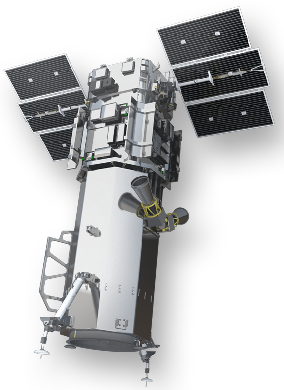
Worldview-3
Mission and sensor parameters
Launched on the 13 August 2014, Worldview-3 is an operational earth imaging satellite which is part of the WorldView constellation (QuickBird, WorldView-1/-2/-3/-4 and GeoEye-1 satellites) and is owned by Maxar Technologies Ltd in the United States. Panchromatic, 4-Bands VIS-NIR, 8-Bands VIS-NIR, and 8-Bands SWIR products are part of the Worldview-3 offer. In the International Charter, Worldview-3 data is gathered via VHR data provisioning of USGS (act as mission Owner in the Charter Governance).
Mission parameters
Table 1 provides a summary of the Worldview-3 mission.
| Parameter | Specifications |
|---|---|
| EO mission | Worldview-3 |
| Providing agency | MAXAR |
| Charter owner agency | USGS |
| Date of launch | 2014-08-13 |
| Temporal coverage | 2014-09-01 - present |
| Mission status | On Going |
| Mission life expected | 12 years |
| Orbit type | Sun-synchronous |
| Equator crossing time | 1:30 PM descending Node |
| Orbit height | 617 km |
| Orbit period | 97 min |
| Revisit frequency | <1.0 day (1 m GSD ), 4.5 days at 20° off-nadir or less |
| Nominal swath width | 13.1 km at nadir |
Sensor specifications
Below specifications of the WV-3 Imager (WV110) optical earth observation sensor on board the Worldview-3 platform.
| Parameter | Specifications |
|---|---|
| Imager Type | Pushbroom with a 35k pixel dectector array for PAN and a 9,3k pixel detector array for MS bands |
| Imaging Mode | PAN and MS (VIS, NIR, RE, SWIR) |
| Pan spectral range | 450 - 800 nm |
| Coastal spectral range | 400 - 450 nm |
| Blue spectral range | 450 - 510 nm |
| Green spectral range | 510 - 580 nm |
| Yellow spectral range | 585 - 625 nm |
| Red spectral range | 630 - 690 nm |
| Red Edge spectral range | 705 - 745 nm |
| NIR1 spectral range | 770 - 895 nm |
| NIR2 spectral range | 860 - 1040 nm |
| SWIR1 spectral range | 1195 - 1225 nm |
| SWIR2 spectral range | 1550 - 1590 nm |
| SWIR3 spectral range | 1640 - 1680 nm |
| SWIR4 spectral range | 1710 - 1750 nm |
| SWIR5 spectral range | 2145 - 2185 nm |
| SWIR6 spectral range | 2185 - 2225 nm |
| SWIR7 spectral range | 2235 - 2285 nm |
| SWIR8 spectral range | 2295 - 2365 nm |
| Resolution | Very High Resolution - O-VHR (0 - 1m) |
| GSD | 31 cm (PAN), 1.25 m (MS), 3.7 m (SWIR) at nadir |
| Dynamic Range | 11-bits per pixel |
In total Worldview-3 spectral Bands are 29:
-
Panchromatic
-
8-band multispectral (coastal, blue, green, yellow, red, red edge, NIR-1 and NIR-2)
-
8-band shortwave infrared (SWIR)
-
12-band CAVIS (corrects for Clouds, Aerosols, Vapors, Ice and Snow)
Worldview-3 products are offered in multiple options as described in the following table:
| Parameter | Specifications |
|---|---|
| 4-Bands Multispectral | Blue, Green, Red, NIR1 |
| 4-Bands Pan-sharpened | Blue, Green, Red, NIR1 |
| 4-Bands Natural Color | pan-sharpened Blue, Green, Red |
| 4-Bands Bundle | PAN, Blue, Green, Red, NIR1 |
| 3-bands Natural Color | pan-sharpened Blue, Green, Red |
| 3-bands Coloured Infrared | pan-sharpened Green, Red, NIR |
| 8-Bands Multispectral | COASTAL, Blue, Green, Yellow, Red, Red EDGE, NIR1, NIR2 |
| 8-Bands Bundle | PAN, COASTAL, Blue, Green, Yellow, Red, Red EDGE, NIR1, NIR2 |
The 4-Bands Multispectral, 8-Bands Multispectral products are the ones often received in the Charter.
Ingested format
Information extracted from product annotation included in the STAC item of a Worldview-3 dataset are listed below.
Properties
STAC item content about properties for a Worldview-3 8-Bands Multispectral Dataset is the following:
  "properties": {
    "platform": "worldview-3",
    "constellation": "worldview-3",
    "mission": "worldview-3",
    "instruments": [
      "msi"
    ],
    "sensor_type": "optical",
    "gsd": 0.00001476469494,
    "datetime": "2022-06-23T06:19:12Z",
    "created": "2022-06-23T17:17:06.7569561Z",
    "updated": "2022-09-01T11:13:35.4086091Z",
    "title": "WORLDVIEW-3 MSI LV1B 2022-06-23 06:19:12",
    "providers": [
      {
        "name": "MAXAR",
        "description": "WorldView-3 is the industry’s first multi-payload, super-spectral, high-resolution commercial satellite. Operating at an altitude of 617 km, WorldView-3 provides 31 cm panchromatic resolution, 1.24 m multispectral resolution, 3.7 m short-wave infrared resolution, and 30 m CAVIS resolution. WorldView-3 has an average revisit time of less than one day and is capable of collecting up to 680,000 sq km per day, further enhancing the Maxar collection capacity for more rapid and reliable collection.",
        "roles": [
          "producer",
          "processor",
          "licensor"
        ],
        "url": "https://resources.maxar.com/data-sheets/worldview-3"
      },
      {
        "name": "USGS",
        "roles": [
          "licensor"
        ]
      }
    ],
    "license": "proprietary",
    "disaster:call_ids": [
      876
    ],
    "disaster:resolution_class": "VHR",
    "cpe:cos2_id": "876-USGS-WORLDVIEW_3-urn_ogc_def_EOP_USGS__WORLDVIEW_3_WV03N33_174861E069_5258332022062300000000MS00",
  }
View
STAC item content about View Geometry for a Worldview-3 Dataset is the following:
  "properties": {
    "view:sun_azimuth": 119.7,
    "view:sun_elevation": 72.8
  }
Processing
STAC item content about Processing for a Worldview-3 Dataset is the following:
  "properties": {
    "processing:level": "LV1B"
  }
Geometry
STAC item content about Geometry for a Worldview-3 Dataset is the following:
  "geometry": {
    "type": "Polygon",
    "coordinates": [
      [
        [
          69.4428607,
          33.1079874
        ],
        [
          69.6181767,
          33.1079874
        ],
        [
          69.6181767,
          33.2277143
        ],
        [
          69.4428607,
          33.2277143
        ],
        [
          69.4428607,
          33.1079874
        ]
      ]
    ]
  },
  "bbox": [
    69.4428607,
    33.1079874,
    69.6181767,
    33.2277143
  ]
Assets
STAC item content about assets (annotation, quicklooks and spectral bands files harvested from the source product) and EO bands for a Worldview-3 8-Bands Multispectral Dataset is the following:
  "assets": {
    "manifest": {
      "type": "application/xml",
      "roles": [
        "metadata"
      ],
      "href": "https://.../WV03N33_174861E069_5258332022062300000000MS00/manifest.XML",
      "filename": "vendor_metadata/22JUN23061912-M1BS-506523462020_01_P002.XML",
      "file:size": 921364
    },
    "overview": {
      "type": "image/jpeg",
      "roles": [
        "overview"
      ],
      "href": "https://.../WV03N33_174861E069_5258332022062300000000MS00/overview.jpg",
      "filename": "WV03N33_174861E069_5258332022062300000000MS00_BR005003002.jpg",
      "file:size": 109235
    },
    "metadata": {
      "type": "text/plain",
      "roles": [
        "metadata"
      ],
      "href": "https://.../WV03N33_174861E069_5258332022062300000000MS00/metadata.txt",
      "filename": "WV03N33_174861E069_5258332022062300000000MS00_DR005003002.txt",
      "file:size": 1954
    },
    "pms": {
      "type": "image/tiff",
      "roles": [
        "data",
        "dn"
      ],
      "href": "https://.../WV03N33_174861E069_5258332022062300000000MS00/pms.tif",
      "filename": "WV03N33_174861E069_5258332022062300000000MS00_GR005003002.tif",
      "file:size": 1540653448,
      "gsd": 0.00001476469494,
      "proj:shape": [
        7168,
        11264
      ],
      "eo:bands": [
        {
          "name": "coastal",
          "common_name": "coastal",
          "center_wavelength": 0.4274,
          "solar_illumination": 1757.89,
          "full_width_half_max": 0.02025
        },
        {
          "name": "blue",
          "common_name": "blue",
          "center_wavelength": 0.4819,
          "solar_illumination": 2004.61,
          "full_width_half_max": 0.027
        },
        {
          "name": "green",
          "common_name": "green",
          "center_wavelength": 0.5471,
          "solar_illumination": 1830.18,
          "full_width_half_max": 0.0309
        },
        {
          "name": "yellow",
          "common_name": "yellow",
          "center_wavelength": 0.6043,
          "solar_illumination": 1712.07,
          "full_width_half_max": 0.01905
        },
        {
          "name": "red",
          "common_name": "red",
          "center_wavelength": 0.6601,
          "solar_illumination": 1535.33,
          "full_width_half_max": 0.02925
        },
        {
          "name": "rededge",
          "common_name": "rededge",
          "center_wavelength": 0.7227,
          "solar_illumination": 1348.08,
          "full_width_half_max": 0.01935
        },
        {
          "name": "nir08",
          "common_name": "nir08",
          "center_wavelength": 0.824,
          "solar_illumination": 1055.94,
          "full_width_half_max": 0.0502
        },
        {
          "name": "nir09",
          "common_name": "nir09",
          "center_wavelength": 0.9136,
          "solar_illumination": 858.77,
          "full_width_half_max": 0.04445
        }
      ],
      "raster:bands": [
        {
          "scale": 0.29778273135802463,
          "offset": -7.154
        },
        {
          "scale": 0.29703507777777777,
          "offset": -4.189
        },
        {
          "scale": 0.19319452233009712,
          "offset": -3.287
        },
        {
          "scale": 0.16544251968503937,
          "offset": -1.816
        },
        {
          "scale": 0.23244964615384614,
          "offset": -1.35
        },
        {
          "scale": 0.1535373850129199,
          "offset": -2.617
        },
        {
          "scale": 0.1615098529880478,
          "offset": -3.752
        },
        {
          "scale": 0.1110618040494938,
          "offset": -1.507
        }
      ]
    },
    "thumbnail": {
      "type": "image/jpeg",
      "roles": [
        "thumbnail"
      ],
      "title": "Acquisition Thumbnail",
      "href": "https://.../WV03N33_174861E069_5258332022062300000000MS00/thumbnail.jpg"
    }
  }
Product Calibration
For Worldview-3 products calibration refer to the Optical Products Calibration (OPT-Calib) service and the calibration sheet available here.