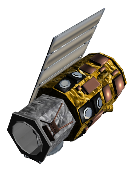
GeoEye-1
Mission and sensor parameters
Launched on the 6 September 2008, GeoEye-1 is an operational earth imaging satellite which is part of the WorldView constellation (QuickBird, WorldView-1/-2/-3/-4 and GeoEye-1 satellites) and is owned by DigitalGlobe in the United States. Operated by Maxar the GeoEye-1 high resolution optical products are available as part of the Maxar Standard Satellite Imagery products. In the International Charter, GeoEye data is gathered via VHR data provisioning of USGS (act as mission Owner in the Charter Governance).
Mission parameters
Table 1 provides a summary of the GeoEye-1 mission.
| Parameter | Specifications |
|---|---|
| EO Mission | GeoEye-1 |
| Charter Owner Agency | USGS |
| Providing Agency | DigitalGlobe |
| Date of launch | 2008-09-06 |
| Temporal coverage | 2008-10-01 - present |
| Mission status | onGoing |
| Mission Life Expected | >10 years |
| Orbit Type | Sun-synchronous |
| Equator crossing Time | 10:30 AM descending node |
| Orbit Height | 681 km |
| Orbit Period | 98 min |
| Revisit Frequency | 2.6 days at 30° off-nadir |
| Nominal Swath Width | 15.3 km at nadir |
Table 1 - GeoEye-1 mission parameters.
Sensor specifications
Below specifications of the GeoEye Imaging System (GIS) optical earth observation sensor on board the GeoEye-1 platform.
| Parameter | Specifications |
|---|---|
| Imager Type | Pushbroom imager. Line scan imaging system with TDI (Time Delay Integration) capability |
| Imaging Mode | PAN and MS (VIS, NIR) |
| Pan spectral range | 450 - 800 nm |
| Blue spectral range | 450 - 510 nm |
| Green spectral range | 510 - 580 nm |
| Red spectral range | 655 - 690 nm |
| NIR spectral range | 780 - 920 nm |
| Resolution | Very High Resolution - O-VHR (0 - 1m) |
| GSD | 41 cm (PAN) and 1.65 (MS) at nadir |
| Dynamic Range | 11-bits per pixel |
Table 2 - GeoEye-1 GIS sensor parameters.
Ingested format
Information extracted from product annotation included in the STAC item of a GeoEye-1 dataset are listed below
Properties
STAC item content about properties for a Geoeye-1 Dataset is the following:
  "properties": {
    "platform": "geoeye-1",
    "constellation": "geoeye-1",
    "mission": "geoeye-1",
    "instruments": [
      "msi"
    ],
    "sensor_type": "optical",
    "gsd": 2,
    "datetime": "2022-08-27T02:33:18Z",
    "created": "2022-08-30T00:08:22.8259172Z",
    "updated": "2022-08-31T15:51:14.6206451Z",
    "title": "GEOEYE-1 MSI LV1B 2022-08-27 02:33:18",
    "providers": [
      {
        "name": "USGS",
        "roles": [
          "licensor"
        ]
      }
    ],
    "license": "proprietary",
    "disaster:call_ids": [
      889
    ],
    "disaster:resolution_class": "VHR",
    "cpe:cos2_id": "889-USGS-GEO_EYE_1-urn_ogc_def_EOP_USGS__GEO_EYE_1_GE01N17_054583E121_6184722022082700000000MS01",
  }
View
STAC item content about View Geometry for a Geoeye-1 Dataset is the following:
  "properties": {
    "view:sun_azimuth": 106.4,
    "view:sun_elevation": 69,
  }
Processing
STAC item content about Processing for a Geoeye-1 Dataset is the following:
  "properties": {
    "processing:level": "LV1B"
  }
Geometry
STAC item content about Geometry for a Geoeye-1 Dataset is the following:
  "geometry": {
    "type": "Polygon",
    "coordinates": [
      [
        [
          121.544444444444,
          17.0383333333333
        ],
        [
          121.6925,
          17.0383333333333
        ],
        [
          121.6925,
          17.0708333333333
        ],
        [
          121.544444444444,
          17.0708333333333
        ],
        [
          121.544444444444,
          17.0383333333333
        ]
      ]
    ]
  },
  "bbox": [
    121.544444444444,
    17.0383333333333,
    121.6925,
    17.0708333333333
  ]
Assets
STAC item content about assets (annotation, quicklooks and spectral bands files harvested from the source product) and EO bands for a Geoeye-1 Dataset is the following:
  "assets": {
    "overview": {
      "type": "image/jpeg",
      "roles": [
        "overview"
      ],
      "href": "https://.../GE01N17_054583E121_6184722022082700000000MS01/overview.jpg",
      "filename": "GE01N17_054583E121_6184722022082700000000MS01_BU003002001.jpg",
      "file:size": 30580
    },
    "metadata": {
      "type": "text/plain",
      "roles": [
        "metadata"
      ],
      "href": "https://.../GE01N17_054583E121_6184722022082700000000MS01/metadata.txt",
      "filename": "GE01N17_054583E121_6184722022082700000000MS01_DU003002001.txt",
      "file:size": 1931
    },
    "bluegreenrednir": {
      "type": "image/tiff",
      "roles": [
        "data",
        "dn"
      ],
      "href": "https://.../GE01N17_054583E121_6184722022082700000000MS01/bluegreenrednir.tif",
      "filename": "GE01N17_054583E121_6184722022082700000000MS01_GU003002001.tif",
      "file:size": 251691672,
      "gsd": 2,
      "proj:shape": [
        3072,
        10240
      ],
      "eo:bands": [
        {
          "name": "blue",
          "common_name": "blue",
          "center_wavelength": 0.48,
          "solar_illumination": 1993.18,
          "full_width_half_max": 0.03
        },
        {
          "name": "green",
          "common_name": "green",
          "center_wavelength": 0.545,
          "solar_illumination": 1828.83,
          "full_width_half_max": 0.03
        },
        {
          "name": "red",
          "common_name": "red",
          "center_wavelength": 0.673,
          "solar_illumination": 1491.49,
          "full_width_half_max": 0.03
        },
        {
          "name": "nir08",
          "common_name": "nir08",
          "center_wavelength": 0.85,
          "solar_illumination": 1022.58,
          "full_width_half_max": 0.03
        }
      ],
      "raster:bands": [
        {
          "scale": 0.15652844999999999,
          "offset": -4.537
        },
        {
          "scale": 0.17079901999999997,
          "offset": -4.175
        },
        {
          "scale": 0.1616161485142857,
          "offset": -3.754
        },
        {
          "scale": 0.09535441999999998,
          "offset": -3.87
        }
      ]
    },
    "rpb": {
      "type": "application/octet-stream",
      "roles": [
        "metadata"
      ],
      "href": "https://.../GE01N17_054583E121_6184722022082700000000MS01/rpb.RPB",
      "filename": "vendor_metadata/22AUG27023318-M1BS-506728946010_01_P002.RPB",
      "file:size": 1862
    },
    "manifest": {
      "type": "application/xml",
      "roles": [
        "metadata"
      ],
      "href": "https://.../GE01N17_054583E121_6184722022082700000000MS01/manifest.XML",
      "filename": "vendor_metadata/22AUG27023318-M1BS-506728946010_01_P002.XML",
      "file:size": 1110700
    },
    "thumbnail": {
      "type": "image/jpeg",
      "roles": [
        "thumbnail"
      ],
      "title": "Acquisition Thumbnail",
      "href": "https://.../GE01N17_054583E121_6184722022082700000000MS01/thumbnail.jpg"
    }
  },
Product Calibration
For GeoEye-1 products calibration refer to the Optical Products Calibration (OPT-Calib) service and the calibration sheet available here.