Sentinel-2
Sentinel-2 MSI multispectral EO data products are calibrated using the Optical Products Calibration (OPT-Calib) service.
The process applied is the same for Sentinel-2 L1C1 and L2A2 acquisitions.
Note
The ESA Charter Mapper supports Sentinel-2 L1C and L2A data acquired from all the platforms.
Input
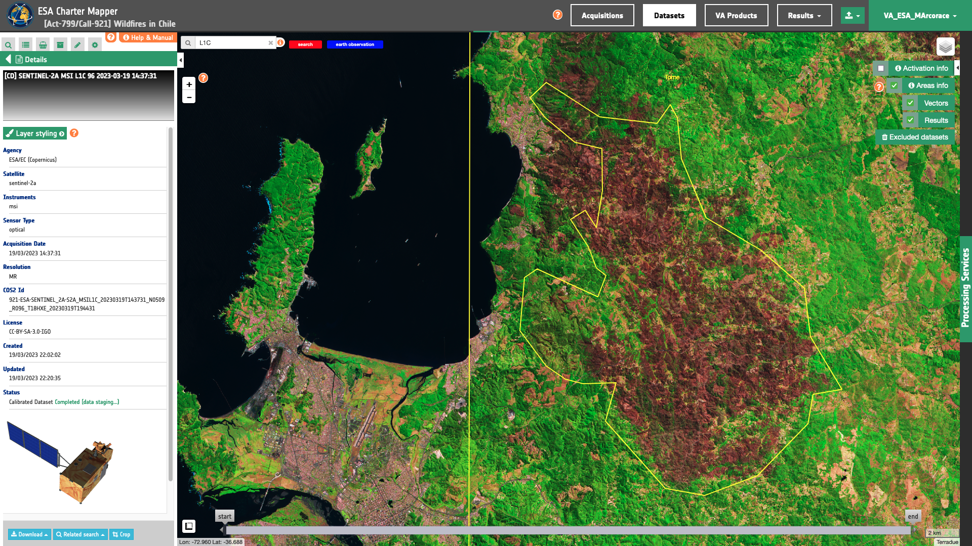
The input is an ingested Sentinel-2 L1C or L2A dataset. Find details here.
DN to Reflectance
Sentinel-2 L1C TOA or L2A BOA reflectance for a band i is derived from DN values using the formula below3,4:
where :
-
\(reflectance_{(i)}\) is the TOA reflectance for a L1C band i
L1C_TOAior BOA reflectance for a L2A band iL2A_BOAi. -
\(DN_{(i)}\) is the digital number for a L1C or L2A band i. The digital number DN=0 represents the “NO_DATA” value.
-
\(addoffset_{(i)}\) is the offset for the band i. This value is extracted from
RADIO_ADD_OFFSETin the L1C metadata orBOA_ADD_OFFSETin the L2A metadata. -
\(quantificationvalue_{(i)}\) is the scaling factor for the band i. This value is extracted from
QUANTIFICATION_VALUEin L1C/L2A metadata.
Note
Starting from the Processing Baseline 04.00 (upgrade of the 29/09/2021), Sentinel-2 L1C and L2A products are provided with negative radiometric values (implementing an offset). In particular, the dynamic range is shifted by a band-dependent constant with the introduction of the RADIO_ADD_OFFSET in the product annotation. This evolution allows avoiding the loss of information due to clamping of negative values in the predefined range [1-32767] occurring over dark surfaces5.
Output
The output is a STAC item GeoJSON6 including single band and overview assets in COG format. Below is given an example of assets included in the STAC item of a Sentinel-2 L1C calibrated dataset.
  "assets": {
    "coastal": {
      "type": "image/tiff; application=geotiff; profile=cloud-optimized",
      "roles": [
        "data",
        "reflectance",
        "visual"
      ],
      "href": "https://.../S2A_MSIL1C_20230319T143731_N0509_R096_T18HXE_20230319T194431-calibrated/coastal.tif",
      "eo:bands": [
        {
          "name": "coastal",
          "description": "coastal 443nm TOA 60",
          "common_name": "coastal",
          "center_wavelength": 0.4427,
          "solar_illumination": 1884.69
        }
      ],
      "raster:bands": [
        {
          "spatial_resolution": 60
          },
      "file:size": 4335987
    },
    "blue": {
      "type": "image/tiff; application=geotiff; profile=cloud-optimized",
      "roles": [
        "data",
        "reflectance",
        "visual"
      ],
      "href": "https://.../S2A_MSIL1C_20230319T143731_N0509_R096_T18HXE_20230319T194431-calibrated/blue.tif",
      "eo:bands": [
        {
          "name": "blue",
          "description": "blue 493nm TOA 10",
          "common_name": "blue",
          "center_wavelength": 0.49269999999999997,
          "solar_illumination": 1959.66
        }
      ],
      "raster:bands": [
        {
          "spatial_resolution": 10
          },
      "file:size": 172441237
    },
    "green": {
      "type": "image/tiff; application=geotiff; profile=cloud-optimized",
      "roles": [
        "data",
        "reflectance",
        "visual"
      ],
      "href": "https://.../S2A_MSIL1C_20230319T143731_N0509_R096_T18HXE_20230319T194431-calibrated/green.tif",
      "eo:bands": [
        {
          "name": "green",
          "description": "green 560nm TOA 10",
          "common_name": "green",
          "center_wavelength": 0.5598,
          "solar_illumination": 1823.24
        }
      ],
      "raster:bands": [
        {
          "spatial_resolution": 10
          },
      "file:size": 175898813
    },
    "red": {
      "type": "image/tiff; application=geotiff; profile=cloud-optimized",
      "roles": [
        "data",
        "reflectance",
        "visual"
      ],
      "href": "https://.../S2A_MSIL1C_20230319T143731_N0509_R096_T18HXE_20230319T194431-calibrated/red.tif",
      "eo:bands": [
        {
          "name": "red",
          "description": "red 665nm TOA 10",
          "common_name": "red",
          "center_wavelength": 0.6646,
          "solar_illumination": 1512.06
        }
      ],
      "raster:bands": [
        {
          "spatial_resolution": 10
          },
      "file:size": 176605557
    },
    "rededge70": {
      "type": "image/tiff; application=geotiff; profile=cloud-optimized",
      "roles": [
        "data",
        "reflectance",
        "visual"
      ],
      "href": "https://.../S2A_MSIL1C_20230319T143731_N0509_R096_T18HXE_20230319T194431-calibrated/rededge70.tif",
      "eo:bands": [
        {
          "name": "rededge70",
          "description": "rededge 704nm TOA 20",
          "common_name": "rededge",
          "center_wavelength": 0.7041000000000001,
          "solar_illumination": 1424.64
        }
      ],
      "raster:bands": [
        {
          "spatial_resolution": 20
          },
      "file:size": 44549081
    },
    "rededge74": {
      "type": "image/tiff; application=geotiff; profile=cloud-optimized",
      "roles": [
        "data",
        "reflectance",
        "visual"
      ],
      "href": "https://.../S2A_MSIL1C_20230319T143731_N0509_R096_T18HXE_20230319T194431-calibrated/rededge74.tif",
      "eo:bands": [
        {
          "name": "rededge74",
          "description": "rededge 740nm TOA 20",
          "common_name": "rededge",
          "center_wavelength": 0.7405,
          "solar_illumination": 1287.61
        }
      ],
      "raster:bands": [
        {
          "spatial_resolution": 20
          },
      "file:size": 45072772
    },
    "rededge78": {
      "type": "image/tiff; application=geotiff; profile=cloud-optimized",
      "roles": [
        "data",
        "reflectance",
        "visual"
      ],
      "href": "https://.../S2A_MSIL1C_20230319T143731_N0509_R096_T18HXE_20230319T194431-calibrated/rededge78.tif",
      "eo:bands": [
        {
          "name": "rededge78",
          "description": "rededge 783nm TOA 20",
          "common_name": "rededge",
          "center_wavelength": 0.7827999999999999,
          "solar_illumination": 1162.08
        }
      ],
      "file:size": 45599615
    },
    "nir": {
      "type": "image/tiff; application=geotiff; profile=cloud-optimized",
      "roles": [
        "data",
        "reflectance",
        "visual"
      ],
      "href": "https://.../S2A_MSIL1C_20230319T143731_N0509_R096_T18HXE_20230319T194431-calibrated/nir.tif",
      "eo:bands": [
        {
          "name": "nir",
          "description": "nir 833nm TOA 10",
          "common_name": "nir",
          "center_wavelength": 0.8328,
          "solar_illumination": 1041.63
        }
      ],
      "raster:bands": [
        {
          "spatial_resolution": 10
          },
      "file:size": 181407007
    },
    "nir08": {
      "type": "image/tiff; application=geotiff; profile=cloud-optimized",
      "roles": [
        "data",
        "reflectance",
        "visual"
      ],
      "href": "https://.../S2A_MSIL1C_20230319T143731_N0509_R096_T18HXE_20230319T194431-calibrated/nir08.tif",
      "eo:bands": [
        {
          "name": "nir08",
          "description": "nir08 865nm TOA 20",
          "common_name": "nir08",
          "center_wavelength": 0.8647,
          "solar_illumination": 955.32
        }
      ],
      "raster:bands": [
        {
          "spatial_resolution": 20
          },
      "file:size": 45887984
    },
    "nir09": {
      "type": "image/tiff; application=geotiff; profile=cloud-optimized",
      "roles": [
        "data",
        "reflectance",
        "visual"
      ],
      "href": "https://.../S2A_MSIL1C_20230319T143731_N0509_R096_T18HXE_20230319T194431-calibrated/nir09.tif",
      "eo:bands": [
        {
          "name": "nir09",
          "description": "nir09 945nm TOA 60",
          "common_name": "nir09",
          "center_wavelength": 0.9451,
          "solar_illumination": 812.92
        }
      ],
      "raster:bands": [
        {
          "spatial_resolution": 60
          },
      "file:size": 3593443
    },
    "cirrus": {
      "type": "image/tiff; application=geotiff; profile=cloud-optimized",
      "roles": [
        "data",
        "reflectance",
        "visual"
      ],
      "href": "https://.../S2A_MSIL1C_20230319T143731_N0509_R096_T18HXE_20230319T194431-calibrated/cirrus.tif",
      "eo:bands": [
        {
          "name": "cirrus",
          "description": "cirrus 1374nm TOA 60",
          "common_name": "cirrus",
          "center_wavelength": 1.3735,
          "solar_illumination": 367.15
        }
      ],
      "raster:bands": [
        {
          "spatial_resolution": 60
          },
      "file:size": 1721236
    },
    "swir16": {
      "type": "image/tiff; application=geotiff; profile=cloud-optimized",
      "roles": [
        "data",
        "reflectance",
        "visual"
      ],
      "href": "https://.../S2A_MSIL1C_20230319T143731_N0509_R096_T18HXE_20230319T194431-calibrated/swir16.tif",
      "eo:bands": [
        {
          "name": "swir16",
          "description": "swir16 1614nm TOA 20",
          "common_name": "swir16",
          "center_wavelength": 1.6137000000000001,
          "solar_illumination": 245.59
        }
      ],
      "raster:bands": [
        {
          "spatial_resolution": 20
          },
      "file:size": 42848582
    },
    "swir22": {
      "type": "image/tiff; application=geotiff; profile=cloud-optimized",
      "roles": [
        "data",
        "reflectance",
        "visual"
      ],
      "href": "https://.../S2A_MSIL1C_20230319T143731_N0509_R096_T18HXE_20230319T194431-calibrated/swir22.tif",
      "eo:bands": [
        {
          "name": "swir22",
          "description": "swir22 2202nm TOA 20",
          "common_name": "swir22",
          "center_wavelength": 2.2024,
          "solar_illumination": 85.25
        }
      ],
      "raster:bands": [
        {
          "spatial_resolution": 20
          },
      "file:size": 41532682
    },
    "overview-trc": {
      "type": "image/tiff; application=geotiff; profile=cloud-optimized",
      "roles": [
        "composite",
        "reflectance",
        "visual"
      ],
      "href": "https://.../S2A_MSIL1C_20230319T143731_N0509_R096_T18HXE_20230319T194431-calibrated/overview-trc.tif",
      "file:size": 198142684
    },
    "overview-civ": {
      "type": "image/tiff; application=geotiff; profile=cloud-optimized",
      "roles": [
        "composite",
        "reflectance",
        "visual"
      ],
      "href": "https://.../S2A_MSIL1C_20230319T143731_N0509_R096_T18HXE_20230319T194431-calibrated/overview-civ.tif",
      "file:size": 203939806
    },
    "overview-sir": {
      "type": "image/tiff; application=geotiff; profile=cloud-optimized",
      "roles": [
        "composite",
        "reflectance",
        "visual"
      ],
      "href": "https://.../S2A_MSIL1C_20230319T143731_N0509_R096_T18HXE_20230319T194431-calibrated/overview-sir.tif",
      "file:size": 51857895
    },
    "overview-atp": {
      "type": "image/tiff; application=geotiff; profile=cloud-optimized",
      "roles": [
        "composite",
        "reflectance",
        "visual"
      ],
      "href": "https://.../S2A_MSIL1C_20230319T143731_N0509_R096_T18HXE_20230319T194431-calibrated/overview-atp.tif",
      "file:size": 50921647
    },
    "overview-fcu": {
      "type": "image/tiff; application=geotiff; profile=cloud-optimized",
      "roles": [
        "composite",
        "reflectance",
        "visual"
      ],
      "href": "https://.../S2A_MSIL1C_20230319T143731_N0509_R096_T18HXE_20230319T194431-calibrated/overview-fcu.tif",
      "file:size": 49544601
    },
    "overview-vea": {
      "type": "image/tiff; application=geotiff; profile=cloud-optimized",
      "roles": [
        "composite",
        "reflectance",
        "visual"
      ],
      "href": "https://.../S2A_MSIL1C_20230319T143731_N0509_R096_T18HXE_20230319T194431-calibrated/overview-vea.tif",
      "file:size": 53131665
    },
    "overview-law": {
      "type": "image/tiff; application=geotiff; profile=cloud-optimized",
      "roles": [
        "composite",
        "reflectance",
        "visual"
      ],
      "href": "https://.../S2A_MSIL1C_20230319T143731_N0509_R096_T18HXE_20230319T194431-calibrated/overview-law.tif",
      "file:size": 53131662
    },
    "overview-wad": {
      "type": "image/tiff; application=geotiff; profile=cloud-optimized",
      "roles": [
        "composite",
        "reflectance",
        "visual"
      ],
      "href": "https://.../S2A_MSIL1C_20230319T143731_N0509_R096_T18HXE_20230319T194431-calibrated/overview-wad.tif",
      "file:size": 5662601
    },
    "overview-trc-low-res": {
      "type": "image/tiff; application=geotiff; profile=cloud-optimized",
      "roles": [
        "composite",
        "overview",
        "reflectance"
      ],
      "href": "https://.../S2A_MSIL1C_20230319T143731_N0509_R096_T18HXE_20230319T194431-calibrated/overview-trc-low-res.tif",
      "file:size": 2210868
    }
  }
-
ESA, Sentinel online, Sentinel-2 User guide, L1 processing level, available at:https://sentinels.copernicus.eu. ↩
-
ESA, Sentinel online, Sentinel-2 User guide, L2A processing level, available at:https://sentinels.copernicus.eu. ↩
-
ESA, Sentinel online, Sentinel-2 Technical guide, Products and Algorithms, Level-1C Product Formatting, available at:https://sentinels.copernicus.eu ↩
-
ESA, Sentinel online, Sentinel-2 Technical guide, Products and Algorithms, Level-2A Product Formatting, available at:https://sentinels.copernicus.eu ↩
-
ESA, Sentinel online, News, Copernicus Sentinel-2: Major Products Upgrade Upcoming 29 September 2021, available at:https://sentinels.copernicus.eu ↩
-
Radiant Earth Foundation, STAC item specifications, a single spatiotemporal asset as a GeoJSON feature plus datetime and links, available at:https://github.com ↩