Upload raster geospatial product
This functionality allows the user to upload a raster geospatial product generated outside the Charter Mapper. Using the file uploaded via the UI a dedicated processor is then triggered which splits each band into a single band asset, converts it to COG and stores it into a STAC item. After the upload the resulting single or multi band asset can be used for visualisation with the assets selection and layer styling functions and for processing using the services available on the platform.
Allowed files to be uploaded
In this upload the user must follow the following guidelines about file type, format and metadata.
Type of file
This function shall be used to upload user products generated outside the platform (e.g. a raster file generated with GIS software) that can be candidates for the generation of an annotated map / VAP. This functionality is not meant to upload EO Satellite data since there is already a dedicated function to upload a single acquisition. Also this function is not the one to be used for the upload of an annotated map / VAP (e.g. a PDF, JPG or GeoPDF for a VAP). For the upload of VAP PM/VAs shall use COS-2.
Format
The raster product to be uploaded shall be in a format that can be managed by the Charter Mapper. The file shall respects the following constraints:
-
Geospatial data type: Raster
-
Bit depth: Int8, Int16, or Float32
-
Format: GeoTIFF
-
Projection: geographic WGS84 (EPSG:4326)
-
Bands: single and/or multi band
-
No data value: all DN values will be valid
Metadata
The user shall supply the metadata associated to the raster to be uploaded in the Charter Mapper:
-
Name / Identifier (mandatory)
-
Title (optional, default to name)
-
Description (optional, default to none)
-
Geometry in WKT (optional)
-
Keywords (optional)
How to upload the product
The Upload Product panel is accessible from the upper menu of the activation workspace interface by clicking on the Upload icon and then on Upload product button from the list.
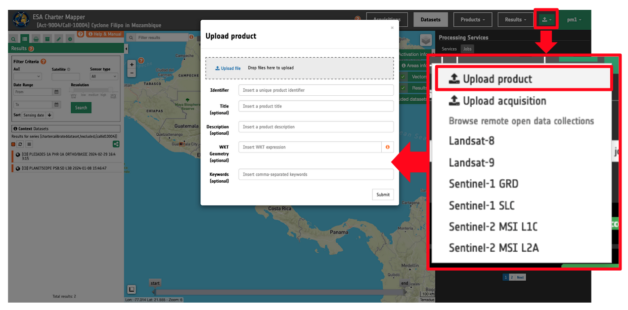
The upload is done through a dedicated form in the geobrowser (similar to the Upload Acquisitions one) requiring the input by the user of minimal information about the product (providing as much as possible pre-filled options)
To upload the product just drag and drop the raster file under the Upload file box. Then fill-in all the parameters following the guidelines explained in the previous section.
Where to find uploaded products
Once uploaded the product is stored and published as a User products (e.g. not among CD or VA products) and accessible via the Results data context under the My products collection.

Upload raster geospatial product for visualisation
Once a product has been successfully uploaded in the Charter Mapper the user has the possibility to visualize the generated asset in the map as per the other assets of Calibrated Datasets or Results from on-demand processing.
Single band raster
When a single band raster is uploaded the resulting STAC item will include only 1 single band asset.
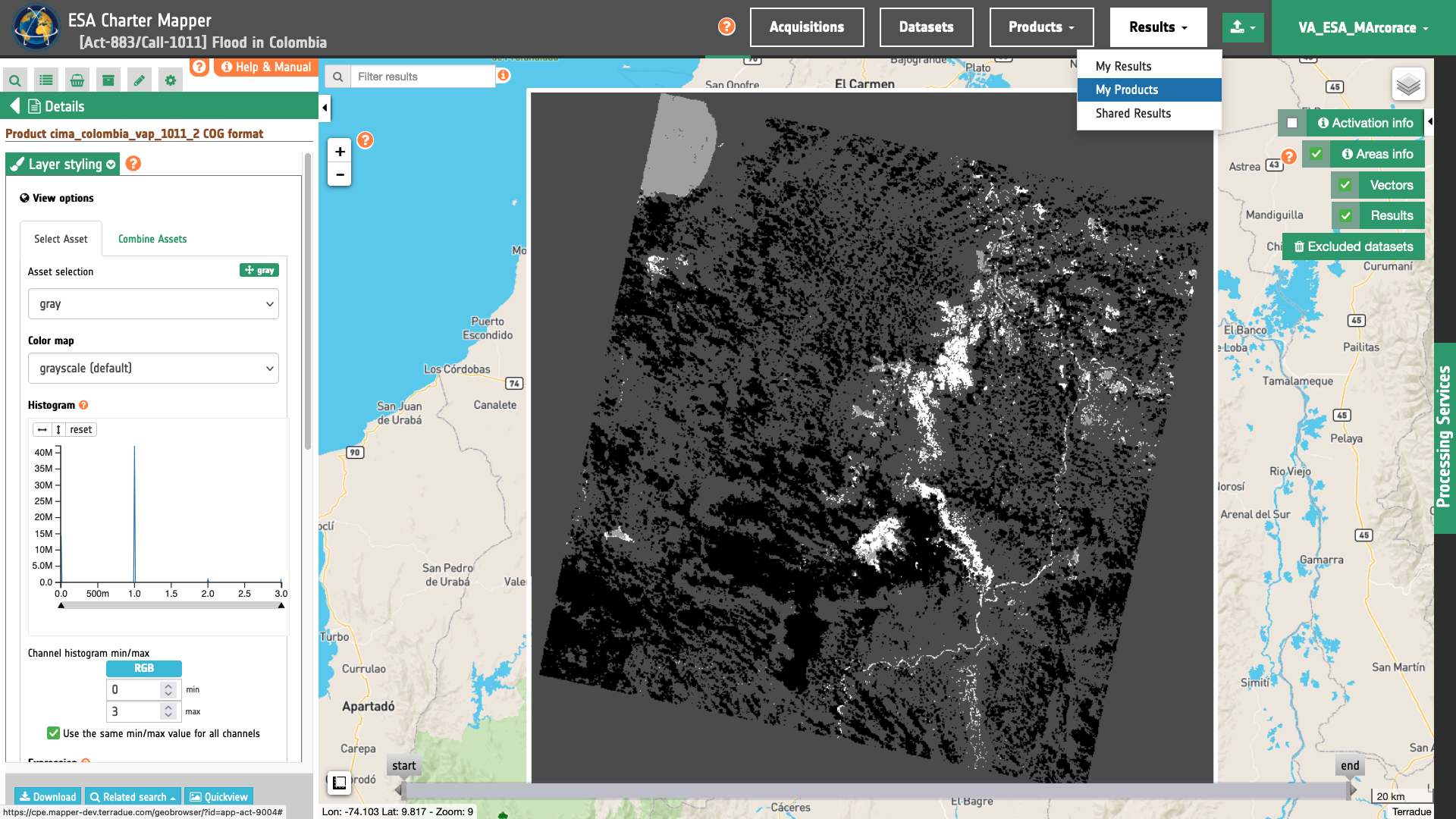
Below is shown an example from the upload of the raster employed in the creation of a VAP of CIMA Research Foundation for the [Act-883/Call-1011] Flood in Colombia. Values for this imported raster are 3 for water, 2 for permanent water, 1 for dry land, and 0 for clouds. At the first access, this asset is shown in the map with the default grayscale color map.
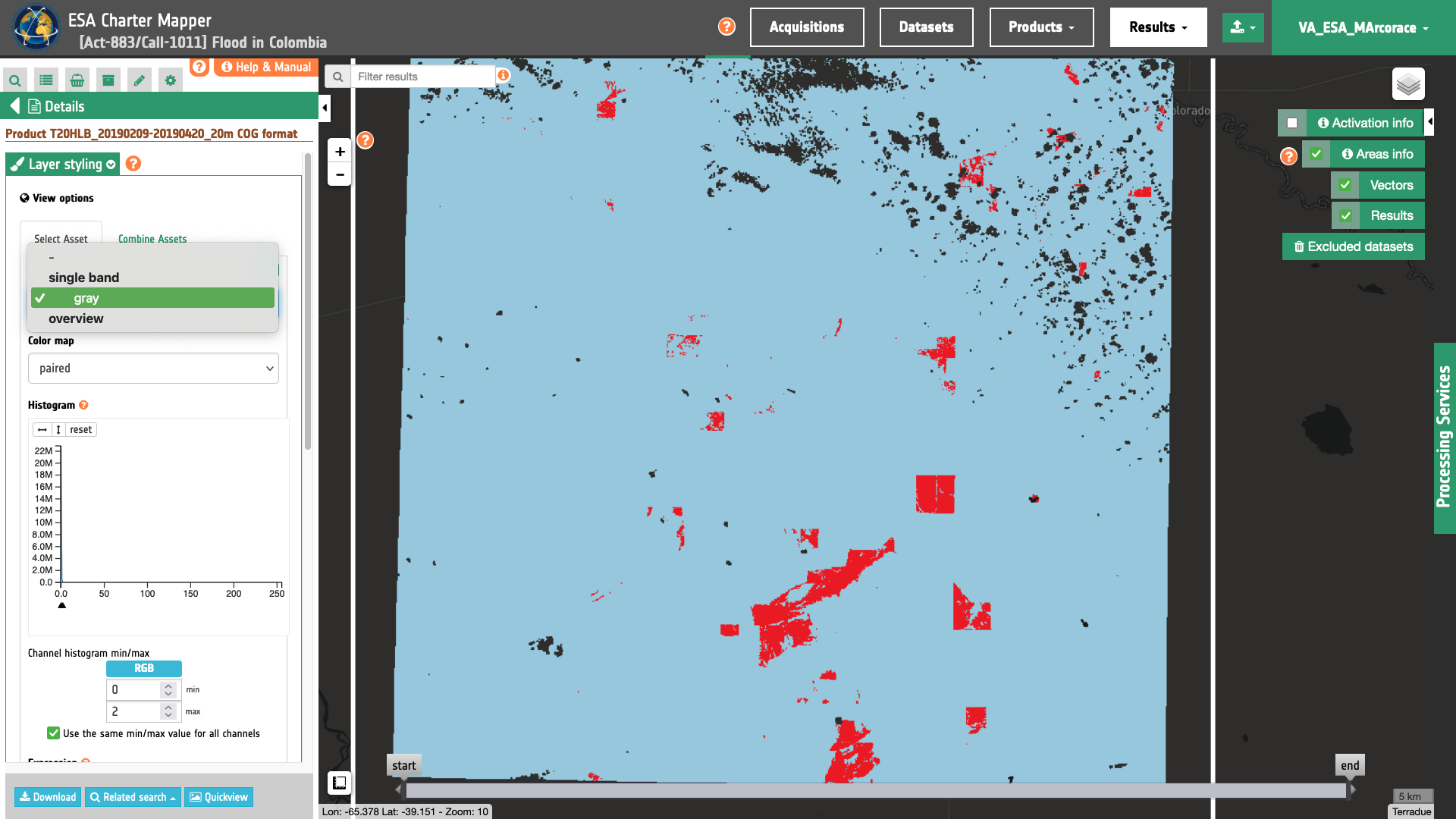
Another example is the below burned area product derived outside the ESA Charter Mapper from Sentinel-2 data acquired over Argentina. Values for this imported raster are 2 for not burnable, 1 for burned, and 0 for burnable which are shown using the paired color map.
Multi band raster
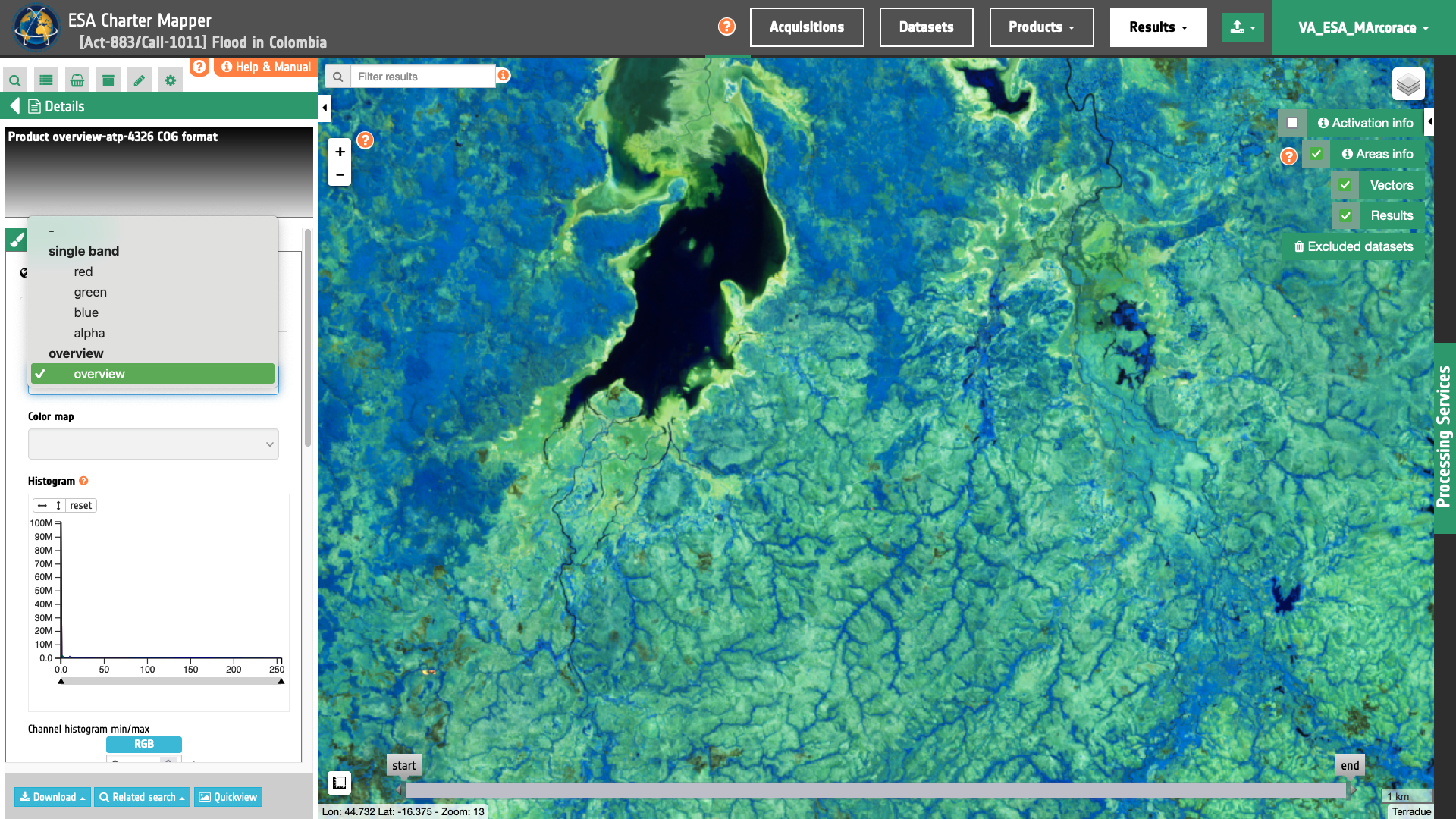
When a multi band raster is uploaded (e.g. an RGBA) the resulting STAC item will include:
-
a single band asset for each band (e.g.
blue,green,red, andalpha). -
an overview asset (RGB composite) named
overviewwhen the uploaded product has 3 bands or more.
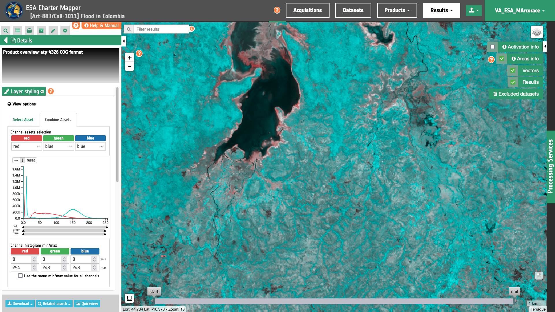
If needed the user can generate RGB composites from the uploaded assets using the Combine assets function.
Upload raster geospatial product for processing
After the upload the user has also the possibility to process the single band assets with on-demand processors.
As an example the user may need to further post-process the uploaded raster with the Filter and Vectorize Discrete Raster service to apply a spatial filtering or converting to vector.
Furthermore, the user may want to employ the uploaded raster for doing band arithmetic with other assets (e.g. a land cover auxiliary asset). As an example using the Co-located Stacking service PM/VAs can co-locate an uploaded water mask raster with a land cover auxiliary asset and then generate another product from them via s-expressions.
Let's consider for instance the upload of a raster employed in the creation of a VAP of CIMA Research Foundation for the [Act-883/Call-1011] Flood in Colombia. Values for this imported raster are 3 for water, 2 for permanent water, 1 for dry land, and 0 for clouds.
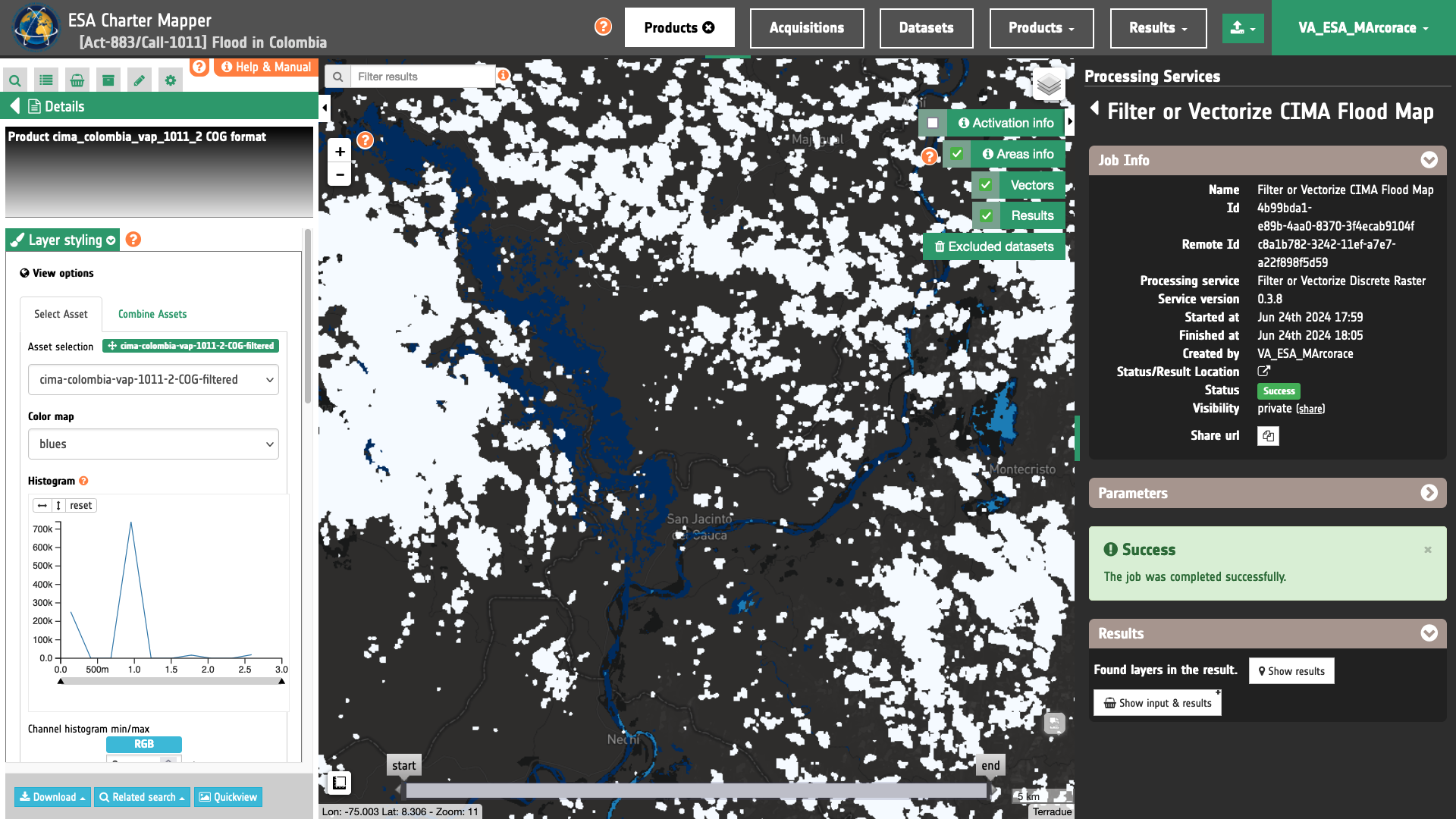
The below figure shows a result by doing a spatial filtering of the Uploaded product with the Filter and Vectorize Discrete Raster service.
After the spatial filtering of this uploaded raster, the user may co-locate this asset 1.cima-colombia-vap-1011-2-COG-filtered with the ESA World Cover auxiliary single band asset 2.worldcover and employ the following s-expression to extract flooded water over croplands:
flooded_cropland:(where (& (== 2.worldcover 40) (== 1.cima-colombia-vap-1011-2-COG-filtered 3)) 1 0)
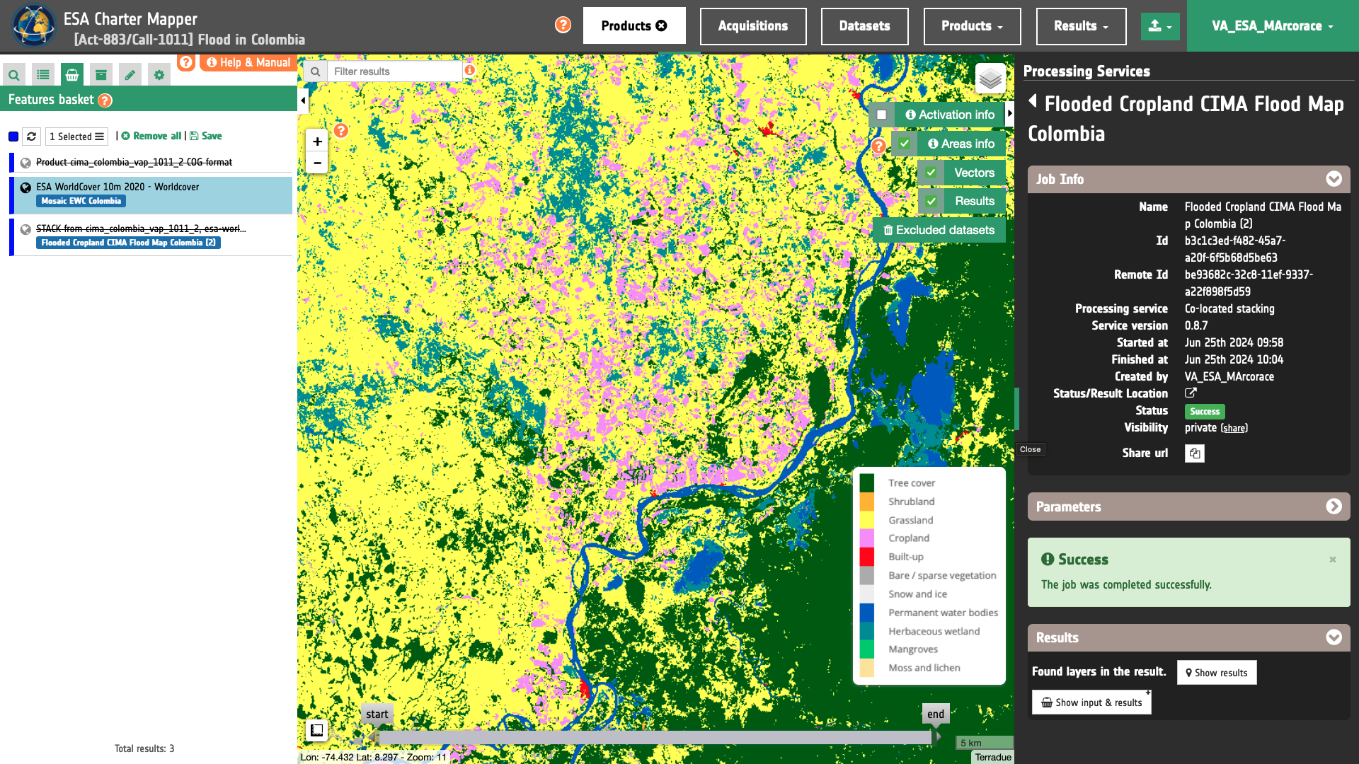
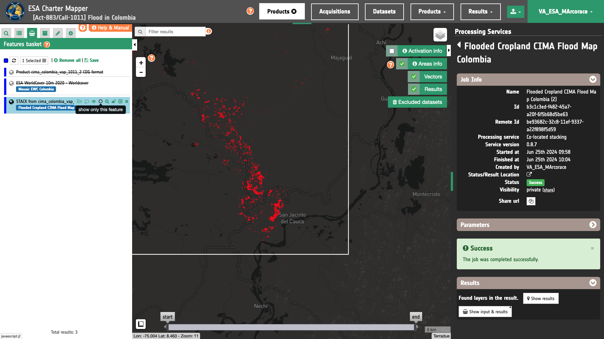
Below figures shows respectively:
-
the
worldcoverco-located ESA World Cover asset, -
the
flooded_croplandsingle band asset generated with the s-expression from the co-located spatially filtered Uploaded CIMA product1.cima-colombia-vap-1011-2-COG-filteredand the ESA World Cover2.worldcoverassets.
