HASARD Single Image service specifications
![]()
This service derives a binary mask of standing water, which can be used to identify potential flood-affected regions. It takes as input the Sigma Nought single band asset of a radar calibrated dataset. The service supports input from the Sentinel-1, RCM, TerraSAR-X, TanDEM-X, and SAOCOM-1 missions.
 The tutorial of the HASARD Single Image service is available in this section.
Service Description
The HASARD Single Image service derives a map of satellite detected surface waters from a single co-pol backscatter image. It supports backscatter images from multiple missions. This service relies on the “HASARD”1 flood mapping algorithm that enables systematic, automatic and reliable SAR mapping of terrestrial water bodies. HASARD implements the Hierarchical Split-Based Approach (HSBA), described by Chini et al. 20172, and is specifically designed to support flooding-related disaster risk reduction at global scale. The underlying end-to-end image processing chain is based on a patented technology from the Luxembourg Institute of Science and Technology (LIST)3 that combines and fully integrates innovative hierarchical image splitting and open water backscatter modelling. The service was developed by LIST and WASDI.
The HASARD Single Image service derives an accurate standing water map from a single satellite image (Sigma Nought asset). In this computation the service employs the Height Above the Nearest Drainage (HAND) dataset to exclude false alarms in slope areas due to layover. HAND auxiliary data is taken from the single band asset hand included into the HAND Auxiliary Dataset, which is derived from the MERIT-Hydro dataset 4,5. HASARD Single Image generates as output a water mask overview and a single band assets both in COG format. The service also returns as output the single band backscatter asset and the HAND asset employed as input in the computation.
Note
This service currently supports single band co-pol sigma nought assets from the following missions: RCM, SAOCOM-1, Sentinel-1, TanDEM-X, and TerraSAR-X data.
Workflow
The HASARD Single Image processing service applies the workflow below:
Input
The input of the HASARD Single Image service is a single band Sigma0 asset in dB, originating from a Calibrated Dataset [CD], and the single band asset from the HAND Auxiliary Dataset. Thus, to employ the service you need the following two single band assets:
-
A co-pol Sigma Nought asset in dB (e.g. s0_db_x_hh for TerraSAR-X) from a SAR Calibrated Dataset acquired during crisis,
-
the
handsingle band asset providing relative elevations in m included into the HAND Auxiliary Dataset.
Warning
HASARD in its hierarchical splitting into tiles of the input backscatter image searches for portions of the images tiles showing a clear bimodal distribution having two Gaussian balanced populations to successfully perform the image binarization required for the classification of water pixels. This approach can be applied with images having a sufficient number of pixels having low backscatter values and therefore is not applicable with input backscatter images over land where no water bodies are present.
Warning
This service does not support SAR complex data (e.g. Sentinel-1 SLC).
Warning
HASARD Single Image requires as input the HAND auxiliary dataset. The hand single band asset must cover the entirety of the footprint of sigma nought asset used as input.
Parameters
The HASARD Single Image service requires a specified number of mandatory and optional parameters. All service parameters are listed in the below Table 1.
| Parameter | Description | Required | Default value |
|---|---|---|---|
| Co-pol sigma nought single band asset | Input co-pol Sigma0 single band asset providing backscatter values in db (e.g. s0_db_x_hh for an HH single band derived from a calibrated Dataset in X-Band) | YES | |
| HAND auxiliary single band asset | Input hand single band asset providing relative elevations in meters from an Auxiliary Dataset |
YES | |
| Starting tiling level | Hierarchical level of splitting. When the level is equal to 1 the image is split into 4 tiles, equal to 2 in 16 tiles, equal to 3 in 64 tiles, etc. |
YES | 0 |
| Check bimodal distribution (Ashman D) | Ashman D coefficient to be used to check bimodal distribution | YES | 2.5 |
| Minimum number of pixels per tile | Minimum number of pixels per tile for checking the bimodality hypothesis | YES | 4000 |
| Number of pixels for small object removal | Number of pixels for small objects (blobs) removal | YES | 20 |
| Threshold for HAND asset | Relative elevation threshold to be considered when mapping water extent. Pixels classified as water that have height above the nearest drainage above this threshold in meters (e.g. 15m) are masked out. | YES | 15 |
| Water backscatter threshold | Backscatter threshold to be considered when mapping water extent. Choose an optimum value of Sigma Nought in dB for the image thresholding (e.g. the value that separates the bimodal distribution). The threshold must be given in decibel (e.g. -20 db). | YES | -20 |
Table 1 - Service parameters for the HASARD Single Image processor.
Input co-pol sigma nought single band asset
The first mandatory parameter is to specify the single band asset that shall be used as input for the water mapping computation (Co-pol Sigma Nought in dB).
Note
To fill in the parameter, the user must drag and drop the co-pol sigma nought single-band asset from the Calibrated Dataset (e.g. s0_db_x_hh from a TerraSAR-X Calibrated Dataset).
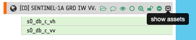
Hint
To quickly find all single band assets included in a Calibrated Dataset, click on the Show assets button available near the feature title. A list with all single-band assets included within the Calibrated Dataset will appear under the feature title.
Warning
Input single band asset specified into the parameter must be a co-pol one. As an example from a full pol calibrated dataset in C-band you must insert either s0_db_c_hh or s0_db_c_hh as asset name.
Note
All CBNs available in the ESA Charter Mapper can be found here.
Input HAND single band asset
For the second mandatory parameter, the user must specify the single band asset from the HAND Auxiliary Dataset to be used for the water mapping computation.
Warning
To fill in the parameter the user must drag and drop the single-band asset hand from the Auxiliary Dataset (e.g. "[CD] MERIT Hydro HAND - Hand").
Hint
Specifications of the hand single band asset can be found here.
HSBA parameters
The following are mandatory parameters three through six:
-
Starting tiling level, -
Check bimodal distribution (Ashman D), -
Minimum number of pixels per tile, -
Number of pixels for small object removal
These are the parameters of the retrieval algorithm. Default values are given in Table 1 and are the ones recommended for a generic use of the algorithm.
Starting tiling level
The HSBA consists of two main steps. First, the original image is split into separate subregions (i.e., tiles) of different sizes. Later, all the tiles showing a clear bimodal behavior with two Gaussian balanced populations are selected for threshold determination. In HSBA, the hierarchical tiling of the image is done using a quad- tree decomposition, which consists of iteratively decomposing image regions into four equally sized quadrants (i.e., tiles), the so-called subquadrants. When the level is equal to 1 the image is split into 4 tiles, equal to 2 in 16 tiles, equal to 3 in 64 tiles, etc Default value is 0.
Check bimodal distribution (Ashman D)
The 2nd of the four mandatory HSBA parameters is dedicated to check the bimodal distribution. The Ashman D (AD) coefficient quantifies how well two Gaussian distributions are separated by considering the distance between their mean values and their dispersions, i.e., standard deviations. For a mixture of two Gaussian distributions, AD > 2 is required for a clear separation of the distributions. Default value is 2.5.
Minimum number of pixels per tile
HSBA searches for tiles of variable size allowing the parametrization of the distributions of two classes. The size of the tiles is not fixed a priori, but is automatically adapted to the information content retrieved from the image. When selecting bimodal tiles at each level the algorithm discard the ones having a low number of pixels. With this parameter the user can define the minimum value of pixels per tile to be considered in the selection of bimodal tiles. Default value is 4000.
Number of pixels for small object removal
The algorithm includes a spatial filtering of the change detection binary mask to remove small isolated object units of water pixels. With this parameter the user can specify the number of pixels composing the smaller object unit. Default value is 20.
HAND threshold
In the seventh mandatory parameter the user must specify a relative elevation threshold to be considered when mapping water extent. Pixels classified as water that have values of Height Above the Nearest Drainage (HAND) above this threshold in meters (e.g. 15m) are masked out. In particular, this threshold is used to derive a binary mask of potential floodplains from the HAND dataset which is then applied for masking the water extent.
Hint
To better define your HAND threshold, select under the Results tab in the left panel the HAND auxiliary dataset, open the Details of this auxiliary dataset, select the hand single band asset, and inspect its histogram. In the map you will see by default the HAND dataset with a grayscale color bar with the min max of the entire dataset. Under Expression insert the following
where((hand<=15),1,0);
and click on the underneath Apply button to visualize in the map the binary mask of potential floodplains applied in HASARD-SI. If you are not happy with the result, change the value of 15 in the expression with another one and click again on the Apply button. The map will be immediately refreshed with the updated binary map. Repeat this binarization on the fly of the HAND asset as much as you need. Once you are satisfied with the binary mask displayed in the map, you can replace the default value of 15 in the HAND threshold parameter with the one you identified.
Water backscatter threshold
In the last mandatory parameter the user must insert a threshold value in decibel (e.g. -20 db) to be used for the computation of water extent from the backscatter signal. The user shall choose an optimum value of Sigma Nought in dB for the image thresholding (e.g. the value that separates the bimodal distribution).
Hint
To better define your backscatter threshold, select under the Results tab in the left panel the Radar Calibrated dataset that you defined as input of HASARD-SI (e.g. [CD] TSX-1 EEC SM HH 86 2012-09-26 17:41:16), open the Details of this calibrated dataset, select the s0_db_B_PP (where PP is the polarization [HH, HV, VH, VV] and B the SAR-band [X,C,L]). Inspect backscatter value using the Get Point Value function after a right click on the map. Employ the Get Point Value function over potential water pixels having low backscatter values. Define the suitable threshold by choosing a value in dB around the average of the left lobe values from the Sigma Nought histogram distribution. More information can be found in Chini et al., 20172.
A good practice is to assign a value that is 3 or 4 decibels higher than the estimated backscattering value of water, taking into account the frequency, polarisation, and incidence angle of the available SAR image. Default value in dB for the water backscatter threshold is -19.
Hint
To take into account of the frequency the water backscatter threshold can be defined as:
-
-17.5 db for sigma nought assets in C-band and X-band,
-
-20 dB for sigma nought assets in L-band.
In case of rough water surfaces (e.g. due to strong wind, rain) the value can be increased by a couple of dB.
Output
The HASARD Single Image processor provides as output the following products:
-
Water extent overview,
-
Water extent single band asset,
-
Input co-pol sigma nought single band asset,
-
Input HAND single band asset co-located to the sigma nought.
HASARD Single Image products specifications can be found in the below tables.
| Attribute | Value / description |
|---|---|
| Long Name | Water Extent RGB composite |
| Short Name | overview-water-mask |
| Description | Water bitmask in the blue channel including transparency |
| Data Type | UnSigned 8-bit Integer |
| Band | 4 |
| Format | COG |
| Projection | UTM or EPSG:4326 - WGS84 |
| Valid Range | [1 - 255] |
| Fill Value | 0 |
| Attribute | Value / description |
|---|---|
| Long Name | Water mask from HASARD Single Image |
| Short Name | water-mask |
| Description | Water extent bitmask: 1=Water, 0 =Not-water |
| Data Type | UnSigned 8-bit Integer |
| Band | 1 |
| Format | COG |
| Projection | UTM or EPSG:4326 - WGS84 |
| Valid Range | [0 - 1] |
| Fill Value | N/A |
| Attribute | Value / description |
|---|---|
| Long Name | Input co-pol sigma nought single band asset |
| Short Name | s0_db_B_PP (where PP is the polarization [HH, HV, VH, VV] and B the SAR-band [X,C,L]) |
| Description | Input single band co-pol sigma nought asset in dB |
| Data Type | Float 32 |
| Band | 1 |
| Format | COG |
| Projection | UTM or EPSG:4326 - WGS84 |
| Valid Range | [0 - 1] |
| Fill Value | N/A |
| Attribute | Value / description |
|---|---|
| Long Name | HAND single band asset after a co-location with the input sigma nought |
| Short Name | hand |
| Description | Height Above the Nearest Drainage from the MERIT Hydro dataset |
| Data Type | Float 32 |
| Band | 1 |
| Format | COG |
| Projection | UTM or EPSG:4326 - WGS84 |
| Resolution | Same of input co-pol sigma nought single band asset |
| Fill Value | -9999 |
Vectorize HASARD water mask single band asset
HASARD-SI's binary water mask can be spatially filtered and / or converted to a vector polygon using the FilterVectorize service of the ESA Charter Mapper.
To polygonize the water-mask single band asset employ the FilterVectorize service in Vectorize mode by selecting only true values DN=1 (water).
If unsatisfied with the spatial filtering offered within the HASARD Single Image service, given the Number of pixels for small object removal parameter, the FilterVectorize service can be used to further post-process the binary mask and remove small isolated clusters of water pixels. Thus, to obtain a further spatially filtered water extent vector, employ the FilterVectorize service in the Filter and Vectorize mode.
Warning
Only the water-mask single band asset can be used in the FilterVectorize on-demand service, being the only discrete raster produced by the HASARD Single Image service.
-
LIST, An automatic satellite image processing tool for flood hazard prevention on a global scale, available at www.list.lu. ↩
-
M. Chini, R. Hostache, L. Giustarini and P. Matgen (2017), "A Hierarchical Split-Based Approach for Parametric Thresholding of SAR Images: Flood Inundation as a Test Case," in IEEE Transactions on Geoscience and Remote Sensing, vol. 55, no. 12, pp. 6975-6988, Dec. 2017, DOI: 10.1109/TGRS.2017.2737664. ↩↩
-
LIST, HASARD developed by the Remote Sensing and Natural Resources Modelling group of the Environmental Research and Innovation Department, available at www.list.lu. ↩
-
Nobre, Antonio & Cuartas, Luz & Hodnett, M & Rennó, Camilo & Medeiros, Grasiela & Silveira, Andre & Waterloo, M.J. & Saleska, Scott. (2011). Height Above the Nearest Drainage - a hydrologically relevant new terrain model. Journal of Hydrology. 404. 13-29. DOI: 10.1016/j.jhydrol.2011.03.051. ↩
-
Yamazaki, D., Ikeshima, D., Sosa, J., Bates, P. D., Allen, G. H., & Pavelsky, T. M. (2019). MERIT Hydro: a high-resolution global hydrography map based on latest topography dataset. Water Resources Research, 55, 5053– 5073. DOI: 10.1029/2019WR024873. ↩