Landsat-8
Mission and sensor parameters
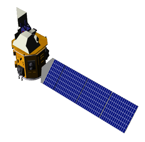
Launched in 2013, Landsat-8 is an operational earth imaging satellite which is part of joint USGS and NASA-led Landsat programme. It represents the first flight unit of the Landsat Data Continuity Mission (LDCM) programme. Landsat-8 payload consists of two Earth observing sensors: the Operational Land Imager (OLI) and the Thermal Infra-Red Scanner (TIRS) instruments.
Mission parameters
Table 1 provides a summary of the Landsat-8 mission.
| Parameter | Specifications |
|---|---|
| EO Mission | Landsat-8 |
| Charter Owner Agency | USGS |
| Providing Agency | NASA, USGS |
| Date of launch | 2013-02-11 |
| Temporal coverage | 2013-03-18 - present |
| Mission status | Operational |
| Mission Life Expected | >10 years |
| Orbit Type | Sun-synchronous |
| Equator crossing Time | 10:00 AM descending node |
| Orbit Height | 705 km |
| Orbit Period | 99 min |
| Revisit Frequency | 16 days |
| Nominal Swath Width | 185 km with a 15 degree field of view |
Table 1 - Landsat-8 mission parameters.
Sensor specifications
Below specifications of the Operational Land Imager (OLI) and the Landsat Thermal Infra-Red Sensor (TIRS) optical earth observation sensors on board the Landsat-8 platform.
| Parameter | Specifications |
|---|---|
| Imager Type | Pushbroom sensor with a four-mirror telescope (OLI) and a thermal imager operating in pushbroom mode TIRS |
| Imaging Mode | PAN and MS (VIS, NIR) |
| Pan spectral range | 503 - 676 nm |
| Coastal spectral range | 435 - 451 nm |
| Blue spectral range | 452 - 512 nm |
| Green spectral range | 533 - 590 nm |
| Red spectral range | 636 - 673 nm |
| NIR spectral range | 851 - 879 nm |
| Cirrus spectral range | 1363 - 1384 nm |
| SWIR-1 spectral range | 1566 - 1651 nm |
| SWIR-2 spectral range | 2107 - 2294 nm |
| TIR-1 spectral range | 10600 - 11190 nm |
| TIR-2 spectral range | 11500 - 12510 nm |
| Resolution | Medium Resolution - 0-MR (4 - 25m) |
| GSD | 15 m (PAN), 30m (MS, NIR, SWIR), 100m (TIR) |
| Dynamic Range | 12-bit scaled to 16-bit integers |
Table 2 - Landsat-8 OLI and TIRS sensors parameters.
Ingested format
Information extracted from product annotation included in the STAC item of a Landsat-8 dataset are listed below
Properties
STAC item content about properties for a Landsat-8 Dataset is the following:
"properties": {
    "created": "2022-08-30T20:58:12.0358674Z",
    "datetime": "2022-08-29T05:50:17.2459459Z",
    "updated": "2022-09-01T15:33:36.6175277Z",
    "platform": "landsat-8",
    "mission": "landsat-8",
    "instruments": [
      "oli",
      "tirs"
    ],
    "sensor_type": "optical",
    "gsd": 15,
    "landsat:wrs_type": 2,
    "landsat:wrs_row": 40,
    "landsat:wrs_path": 151,
    "landsat:scene_id": "LC81510402022241LGN00",
    "landsat:collection_number": "02",
    "landsat:collection_category": "RT",
    "landsat:cloud_cover_land": 11.19,
    "title": "LANDSAT-8 OLI TIRS L1TP 2022-08-29 05:50:17",
    "providers": [
      {
        "name": "USGS",
        "roles": [
          "licensor"
        ]
      }
    ],
    "license": "CC-BY-SA-3.0-IGO",
    "disaster:call_ids": [
      890
    ],
    "disaster:resolution_class": "LR",
    "cpe:cos2_id": "890-USGS-LANDSAT8-urn_ogc_def_EOP_USGS__LANDSAT8_LS081510402022082900000000MS00",
  }
Satellite
STAC item content about Satellite for a Landsat-8 Dataset is the following:
  "properties": {
    "sat:absolute_orbit": 151,
    "sat:relative_orbit": 151,
    "sat:orbit_state": "descending",
  }
View
STAC item content about View Geometry for a Landsat-8 Dataset is the following:
  "properties": {
    "view:off_nadir": 0,
    "view:incidence_angle": 0,
    "view:sun_azimuth": 128.25795565,
    "view:sun_elevation": 61.24746691
  }
Processing
STAC item content about Processing for a Landsat-8 Dataset is the following:
  "properties": {
    "processing:level": "L1TP"
  }
Geometry
STAC item content about Geometry for a Landsat-8 Dataset is the following:
  "geometry": {
    "type": "Polygon",
    "coordinates": [
      [
        [
          69.01036,
          29.91981
        ],
        [
          69.01015,
          27.82124
        ],
        [
          71.32446,
          27.80167
        ],
        [
          71.37159,
          29.89848
        ],
        [
          69.01036,
          29.91981
        ]
      ]
    ]
  }
  "properties": {
    "gsd": 15,
    "proj:epsg": 32642,
    "proj:wkt2": "PROJCS[\"WGS 84 / UTM zone 42N\", GEOGCS[\"WGS 84\", DATUM[\"World Geodetic System 1984\", SPHEROID[\"WGS 84\", 6378137, 298.257223563, AUTHORITY[\"EPSG\", \"7030\"]], AUTHORITY[\"EPSG\", \"6326\"]], PRIMEM[\"Greenwich\", 0, AUTHORITY[\"EPSG\", \"8901\"]], UNIT[\"degree\", 0.017453292519943295, AUTHORITY[\"EPSG\", \"9102\"]], AUTHORITY[\"EPSG\", \"4326\"]], UNIT[\"metre\", 1, AUTHORITY[\"EPSG\", \"9001\"]], PROJECTION[\"UTM42N\", AUTHORITY[\"EPSG\", \"32642\"]], PARAMETER[\"latitude_of_origin\", 0], PARAMETER[\"central_meridian\", 69], PARAMETER[\"scale_factor\", 0.9996], PARAMETER[\"false_easting\", 500000], PARAMETER[\"false_northing\", 0], AUTHORITY[\"EPSG\", \"32642\"], AXIS[\"East\", EAST], AXIS[\"North\", NORTH]]",
  }
  "bbox": [
    69.01015,
    27.80167,
    71.37159,
    29.91981
  ]
Assets
STAC item content about assets (annotation, quicklooks and spectral bands files harvested from the source product) and EO bands for a Landsat-8 Dataset is the following:
  "assets": {
    "B1": {
      "type": "image/tiff",
      "roles": [
        "data"
      ],
      "href": "https://.../LC08_L1TP_151040_20220829_20220829_02_RT/B1.TIF",
      "filename": "LS081510402022082900000000MS00_B01.TIF",
      "file:size": 92295386,
      "proj:shape": [
        7601,
        7751
      ],
      "gsd": 30,
      "eo:bands": [
        {
          "name": "B1",
          "common_name": "coastal",
          "center_wavelength": 0.44,
          "full_width_half_max": 0.02
        }
      ],
      "raster:bands": [
        {
          "spatial_resolution": 30
        }
      ]
    },
    "B2": {
      "type": "image/tiff",
      "roles": [
        "data"
      ],
      "href": "https://.../LC08_L1TP_151040_20220829_20220829_02_RT/B2.TIF",
      "filename": "LS081510402022082900000000MS00_B02.TIF",
      "file:size": 93873590,
      "proj:shape": [
        7601,
        7751
      ],
      "gsd": 30,
      "eo:bands": [
        {
          "name": "B2",
          "common_name": "blue",
          "center_wavelength": 0.48,
          "full_width_half_max": 0.06
        }
      ],
      "raster:bands": [
        {
          "spatial_resolution": 30
        }
      ]
    },
    "B3": {
      "type": "image/tiff",
      "roles": [
        "data"
      ],
      "href": "https://.../LC08_L1TP_151040_20220829_20220829_02_RT/B3.TIF",
      "filename": "LS081510402022082900000000MS00_B03.TIF",
      "file:size": 96151910,
      "proj:shape": [
        7601,
        7751
      ],
      "gsd": 30,
      "eo:bands": [
        {
          "name": "B3",
          "common_name": "green",
          "center_wavelength": 0.56,
          "full_width_half_max": 0.06
        }
      ],
      "raster:bands": [
        {
          "spatial_resolution": 30
        }
      ]
    },
    "B4": {
      "type": "image/tiff",
      "roles": [
        "data"
      ],
      "href": "https://.../LC08_L1TP_151040_20220829_20220829_02_RT/B4.TIF",
      "filename": "LS081510402022082900000000MS00_B04.TIF",
      "file:size": 98168699,
      "proj:shape": [
        7601,
        7751
      ],
      "gsd": 30,
      "eo:bands": [
        {
          "name": "B4",
          "common_name": "red",
          "center_wavelength": 0.65,
          "full_width_half_max": 0.04
        }
      ],
      "raster:bands": [
        {
          "spatial_resolution": 30
        }
      ]
    },
    "B5": {
      "type": "image/tiff",
      "roles": [
        "data"
      ],
      "href": "https://.../LC08_L1TP_151040_20220829_20220829_02_RT/B5.TIF",
      "filename": "LS081510402022082900000000MS00_B05.TIF",
      "file:size": 101468779,
      "proj:shape": [
        7601,
        7751
      ],
      "gsd": 30,
      "eo:bands": [
        {
          "name": "B5",
          "common_name": "nir",
          "center_wavelength": 0.86,
          "full_width_half_max": 0.03
        }
      ],
      "raster:bands": [
        {
          "spatial_resolution": 30
        }
      ]
    },
    "B6": {
      "type": "image/tiff",
      "roles": [
        "data"
      ],
      "href": "https://.../LC08_L1TP_151040_20220829_20220829_02_RT/B6.TIF",
      "filename": "LS081510402022082900000000MS00_B06.TIF",
      "file:size": 100728704,
      "proj:shape": [
        7601,
        7751
      ],
      "gsd": 30,
      "eo:bands": [
        {
          "name": "B6",
          "common_name": "swir16",
          "center_wavelength": 1.6,
          "full_width_half_max": 0.08
        }
      ],
      "raster:bands": [
        {
          "spatial_resolution": 30
        }
      ]
    },
    "B7": {
      "type": "image/tiff",
      "roles": [
        "data"
      ],
      "href": "https://.../LC08_L1TP_151040_20220829_20220829_02_RT/B7.TIF",
      "filename": "LS081510402022082900000000MS00_B07.TIF",
      "file:size": 98961517,
      "proj:shape": [
        7601,
        7751
      ],
      "gsd": 30,
      "eo:bands": [
        {
          "name": "B7",
          "common_name": "swir22",
          "center_wavelength": 2.2,
          "full_width_half_max": 0.2
        }
      ],
      "raster:bands": [
        {
          "spatial_resolution": 30
        }
      ]
    },
    "B8": {
      "type": "image/tiff",
      "roles": [
        "data"
      ],
      "href": "https://.../LC08_L1TP_151040_20220829_20220829_02_RT/B8.TIF",
      "filename": "LS081510402022082900000000MS00_B08.TIF",
      "file:size": 383543681,
      "proj:shape": [
        15201,
        15501
      ],
      "gsd": 15,
      "eo:bands": [
        {
          "name": "B8",
          "common_name": "pan",
          "center_wavelength": 0.59,
          "full_width_half_max": 0.18
        }
      ],
      "raster:bands": [
        {
          "spatial_resolution": 15
        }
      ]
    },
    "B9": {
      "type": "image/tiff",
      "roles": [
        "data"
      ],
      "href": "https://.../LC08_L1TP_151040_20220829_20220829_02_RT/B9.TIF",
      "filename": "LS081510402022082900000000MS00_B09.TIF",
      "file:size": 50641798,
      "proj:shape": [
        7601,
        7751
      ],
      "gsd": 30,
      "eo:bands": [
        {
          "name": "B9",
          "common_name": "cirrus",
          "center_wavelength": 1.37,
          "full_width_half_max": 0.02
        }
      ],
      "raster:bands": [
        {
          "spatial_resolution": 30
        }
      ]
    },
    "B10": {
      "type": "image/tiff",
      "roles": [
        "data"
      ],
      "href": "https://.../LC08_L1TP_151040_20220829_20220829_02_RT/B10.TIF",
      "filename": "LS081510402022082900000000MS00_B10.TIF",
      "file:size": 82969917,
      "proj:shape": [
        7601,
        7751
      ],
      "gsd": 100,
      "eo:bands": [
        {
          "name": "B10",
          "common_name": "lwir11",
          "center_wavelength": 10.9,
          "full_width_half_max": 0.8
        }
      ],
      "raster:bands": [
        {
          "spatial_resolution": 30
        }
      ]
    },
    "B11": {
      "type": "image/tiff",
      "roles": [
        "data"
      ],
      "href": "https://.../LC08_L1TP_151040_20220829_20220829_02_RT/B11.TIF",
      "filename": "LS081510402022082900000000MS00_B11.TIF",
      "file:size": 78220309,
      "proj:shape": [
        7601,
        7751
      ],
      "gsd": 100,
      "eo:bands": [
        {
          "name": "B11",
          "common_name": "lwir12",
          "center_wavelength": 12,
          "full_width_half_max": 1
        }
      ],
      "raster:bands": [
        {
          "spatial_resolution": 30
        }
      ]
    },
    "angle_coefficient": {
      "type": "text/plain",
      "roles": [
        "metadata"
      ],
      "href": "https://.../LC08_L1TP_151040_20220829_20220829_02_RT/angle_coefficient.txt",
      "filename": "vendor_metadata/LC08_L1TP_151040_20220829_20220829_02_RT_ANG.txt",
      "file:size": 117391
    },
    "metadata": {
      "type": "text/plain",
      "roles": [
        "metadata"
      ],
      "href": "https://.../LC08_L1TP_151040_20220829_20220829_02_RT/metadata.txt",
      "filename": "vendor_metadata/LC08_L1TP_151040_20220829_20220829_02_RT_MTL.txt",
      "file:size": 12368
    },
    "overview": {
      "type": "image/jpeg",
      "roles": [
        "overview"
      ],
      "title": "Acquisition Overview",
      "href": "https://.../LC08_L1TP_151040_20220829_20220829_02_RT/overview.jpg"
    },
    "thumbnail": {
      "type": "image/jpeg",
      "roles": [
        "thumbnail"
      ],
      "title": "Acquisition Thumbnail",
      "href": "https://.../LC08_L1TP_151040_20220829_20220829_02_RT/thumbnail.jpg"
    }
  }
Product Calibration
For Landsat-8 products calibration refer to the Optical Products Calibration (OPT-Calib) service and the calibration sheet available here.