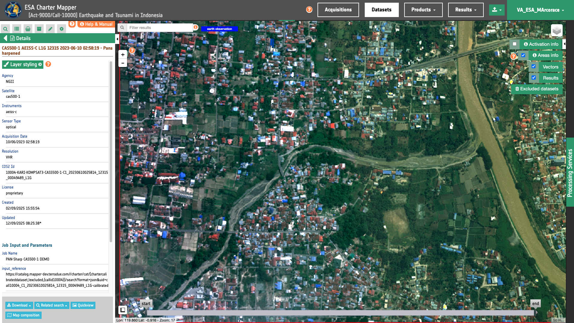
CAS500-1
CAS500-1 L1G panchromatic and multispectral EO data products are calibrated using the Optical Products Calibration (OPT-Calib) service. The process applied is the same for PAN and MS acquisitions.
Input
The input is an ingested CAS500-1 Dataset, find details here.
DN to Radiance
For the conversion from \(DN\) (for Digital Numbers) to spectral radiance (or ‘TOA radiance’) \(L \), the following formula is used :
\(L \) in \(W/m^2/steradians/micrometers\) with \(b\) being a band ID.
The gain and offset values are derived from yearly updated coefficients provided by the National Satellite Center of Korean National Geographic Information Institute based on ground observations.
Radiance to Reflectance
To convert TOA radiance to TOA reflectance, the following formula is used:
where :
-
\(L(b)\) is the spectral radiance for band b
-
\(pi\) is the famous mathematical constant
-
\(d\) is the earth-sun distance (in astronomical units) and depends on the acquisition’s day and month
-
\(ESUN(b)\) is the mean TOA solar irradiance (or solar illumination) in \(W/m^2/micrometers\)
-
\(θ\) is the solar zenith angle in degrees.
The conversion from elevation angle to solar zenith angle \(θ\) (in degrees) is:
The values for the \(ESUN(b)\) are based on Thuillier 2003 as described in Table 1.
| Band | λ(nm) | ESUN (Thuillier 2003) mW m^-2 nm^-1 |
|---|---|---|
| PAN | 450-900 | 1258.38 |
| Blue | 450-520 | 1984.65 |
| Green | 520-600 | 1815.54 |
| Red | 630-690 | 1536.38 |
| NIR | 760-900 | 967.99 |
Table 6: ESUN values for CAS500-1 AEISS-C Imager bands.
Output
The output is a STAC item GeoJSON1 including the assets shown below
  "assets": {
    "pan": {
      "type": "image/tiff; application=geotiff; profile=cloud-optimized",
      "roles": [
        "data",
        "reflectance",
        "visual"
      ],
      "href": "https://.../calibratedDatasets/C1_20230610025814_12315_00049489_L1G-calibrated/pan.tif",
      "eo:bands": [
        {
          "name": "pan",
          "common_name": "pan",
          "center_wavelength": 0.675,
          "full_width_half_max": 0.45,
          "solar_illumination": 1258.38
        }
      ],
      "raster:bands": [
        {
          "spatial_resolution": 0.5,
          "statistics": {
            "minimum": 0,
            "maximum": 7562,
            "mean": 2471.5104115037,
            "stddev": 1649.5555761222,
            "valid_percent": 100
          },
          "histogram": {
            "count": 256,
            "min": -14.8274509803922,
            "max": 7576.82745098039
          }
        }
      ],
      "file:size": 1264137190
    },
    "blue": {
      "type": "image/tiff; application=geotiff; profile=cloud-optimized",
      "roles": [
        "data",
        "reflectance",
        "visual"
      ],
      "href": "https://.../calibratedDatasets/C1_20230610025814_12315_00049489_L1G-calibrated/blue.tif",
      "eo:bands": [
        {
          "name": "blue",
          "common_name": "blue",
          "center_wavelength": 0.485,
          "full_width_half_max": 0.07,
          "solar_illumination": 1984.65
        }
      ],
      "raster:bands": [
        {
          "spatial_resolution": 2,
          "statistics": {
            "minimum": 0,
            "maximum": 6595,
            "mean": 1610.1168525565,
            "stddev": 1189.4785714614,
            "valid_percent": 100
          },
          "histogram": {
            "count": 256,
            "min": -12.9313725490196,
            "max": 6607.93137254902
          }
        }
      ],
      "file:size": 71363545
    },
    "green": {
      "type": "image/tiff; application=geotiff; profile=cloud-optimized",
      "roles": [
        "data",
        "reflectance",
        "visual"
      ],
      "href": "https://.../calibratedDatasets/C1_20230610025814_12315_00049489_L1G-calibrated/green.tif",
      "eo:bands": [
        {
          "name": "green",
          "common_name": "green",
          "center_wavelength": 0.56,
          "full_width_half_max": 0.08,
          "solar_illumination": 1815.54
        }
      ],
      "raster:bands": [
        {
          "spatial_resolution": 2,
          "statistics": {
            "minimum": 0,
            "maximum": 6221,
            "mean": 1639.6850050845,
            "stddev": 1170.3699460103,
            "valid_percent": 100
          },
          "histogram": {
            "count": 256,
            "min": -12.1980392156863,
            "max": 6233.19803921569
          }
        }
      ],
      "key": "green",
      "file:size": 76923682
    },
    "red": {
      "type": "image/tiff; application=geotiff; profile=cloud-optimized",
      "roles": [
        "data",
        "reflectance",
        "visual"
      ],
      "href": "https://.../calibratedDatasets/C1_20230610025814_12315_00049489_L1G-calibrated/red.tif",
      "eo:bands": [
        {
          "name": "red",
          "common_name": "red",
          "center_wavelength": 0.66,
          "full_width_half_max": 0.06,
          "solar_illumination": 1536.38
        }
      ],
      "raster:bands": [
        {
          "spatial_resolution": 2,
          "statistics": {
            "minimum": 0,
            "maximum": 9938,
            "mean": 1460.1066545323,
            "stddev": 1100.6730889244,
            "valid_percent": 100
          },
          "histogram": {
            "count": 256,
            "min": -19.4862745098039,
            "max": 9957.4862745098
          }
        }
      ],
      "key": "red",
      "file:size": 75080358
    },
    "nir": {
      "type": "image/tiff; application=geotiff; profile=cloud-optimized",
      "roles": [
        "data",
        "reflectance",
        "visual"
      ],
      "href": "https://.../calibratedDatasets/C1_20230610025814_12315_00049489_L1G-calibrated/nir.tif",
      "eo:bands": [
        {
          "name": "nir",
          "common_name": "nir",
          "center_wavelength": 0.83,
          "full_width_half_max": 0.14,
          "solar_illumination": 967.99
        }
      ],
      "raster:bands": [
        {
          "spatial_resolution": 2,
          "statistics": {
            "minimum": 0,
            "maximum": 10000,
            "mean": 2748.6915238585,
            "stddev": 1869.6571688402,
            "valid_percent": 100
          },
          "histogram": {
            "count": 256,
            "min": -19.6078431372549,
            "max": 10019.6078431373
          }
        }
      ],
      "key": "nir",
      "file:size": 86763418
    },
    "ndvi": {
      "type": "image/tiff; application=geotiff; profile=cloud-optimized",
      "roles": [
        "data",
        "visual"
      ],
      "href": "https://.../calibratedDatasets/C1_20230610025814_12315_00049489_L1G-calibrated/ndvi.tif",
      "raster:bands": [
        {
          "spatial_resolution": 2,
          "statistics": {
            "minimum": -0.99855470657349,
            "maximum": 0.95955508947372,
            "mean": 0.30803732848255,
            "stddev": 0.15089579239428,
            "valid_percent": 71.81
          },
          "histogram": {
            "count": 256,
            "min": -1.00239413754613,
            "max": 0.963394520446362
          }
        }
      ],
      "file:size": 195089108
    },
    "ndwi": {
      "type": "image/tiff; application=geotiff; profile=cloud-optimized",
      "roles": [
        "data",
        "visual"
      ],
      "href": "https://.../calibratedDatasets/C1_20230610025814_12315_00049489_L1G-calibrated/ndwi.tif",
      "raster:bands": [
        {
          "spatial_resolution": 2,
          "statistics": {
            "minimum": -0.64886575937271,
            "maximum": 0.99839359521866,
            "mean": -0.25098542213819,
            "stddev": 0.12634380042337,
            "valid_percent": 71.81
          },
          "histogram": {
            "count": 256,
            "min": -0.65209567967583,
            "max": 1.00162351552178
          }
        }
      ],
      "file:size": 195325011
    },
    "overview-trc": {
      "type": "image/tiff; application=geotiff; profile=cloud-optimized",
      "roles": [
        "composite",
        "visual"
      ],
      "href": "https://.../calibratedDatasets/C1_20230610025814_12315_00049489_L1G-calibrated/overview-trc.tif",
      "raster:bands": [
        {
          "spatial_resolution": 2,
          "statistics": {
            "minimum": 0,
            "maximum": 254,
            "mean": 103.63233070993,
            "stddev": 71.862170254403,
            "valid_percent": 100
          },
          "histogram": {
            "count": 256,
            "min": -0.5,
            "max": 255.5
          }
        },
        {
          "spatial_resolution": 2,
          "statistics": {
            "minimum": 0,
            "maximum": 251,
            "mean": 116.46023545071,
            "stddev": 76.70785817128,
            "valid_percent": 100
          },
          "histogram": {
            "count": 256,
            "min": -0.5,
            "max": 255.5
          }
        },
        {
          "spatial_resolution": 2,
          "statistics": {
            "minimum": 0,
            "maximum": 252,
            "mean": 113.88800403006,
            "stddev": 74.74403832483,
            "valid_percent": 100
          },
          "histogram": {
            "count": 256,
            "min": -0.5,
            "max": 255.5
          }
        },
        {
          "spatial_resolution": 2,
          "statistics": {
            "minimum": 0,
            "maximum": 255,
            "mean": 183.10392703549,
            "stddev": 114.73645148004,
            "valid_percent": 100
          },
          "histogram": {
            "count": 256,
            "min": -0.5,
            "max": 255.5
          }
        }
      ],
      "file:size": 111525078
    },
    "overview-civ": {
      "type": "image/tiff; application=geotiff; profile=cloud-optimized",
      "roles": [
        "composite",
        "visual"
      ],
      "href": "https://.../calibratedDatasets/C1_20230610025814_12315_00049489_L1G-calibrated/overview-civ.tif",
      "raster:bands": [
        {
          "spatial_resolution": 2,
          "statistics": {
            "minimum": 0,
            "maximum": 254,
            "mean": 160.85021961955,
            "stddev": 102.09774958046,
            "valid_percent": 100
          },
          "histogram": {
            "count": 256,
            "min": -0.5,
            "max": 255.5
          }
        },
        {
          "spatial_resolution": 2,
          "statistics": {
            "minimum": 0,
            "maximum": 254,
            "mean": 103.63233070993,
            "stddev": 71.862170254403,
            "valid_percent": 100
          },
          "histogram": {
            "count": 256,
            "min": -0.5,
            "max": 255.5
          }
        },
        {
          "spatial_resolution": 2,
          "statistics": {
            "minimum": 0,
            "maximum": 251,
            "mean": 116.46023545071,
            "stddev": 76.70785817128,
            "valid_percent": 100
          },
          "histogram": {
            "count": 256,
            "min": -0.5,
            "max": 255.5
          }
        },
        {
          "spatial_resolution": 2,
          "statistics": {
            "minimum": 0,
            "maximum": 255,
            "mean": 183.10392703549,
            "stddev": 114.73645148004,
            "valid_percent": 100
          },
          "histogram": {
            "count": 256,
            "min": -0.5,
            "max": 255.5
          }
        }
      ],
      "file:size": 115844583
    },
    "overview-pan": {
      "type": "image/tiff; application=geotiff; profile=cloud-optimized",
      "roles": [
        "composite",
        "visual"
      ],
      "href": "https://.../calibratedDatasets/C1_20230610025814_12315_00049489_L1G-calibrated/overview-pan.tif",
      "raster:bands": [
        {
          "spatial_resolution": 0.5,
          "statistics": {
            "minimum": 0,
            "maximum": 192,
            "mean": 62.665586780224,
            "stddev": 41.853594909766,
            "valid_percent": 100
          },
          "histogram": {
            "count": 256,
            "min": -0.5,
            "max": 255.5
          }
        },
        {
          "spatial_resolution": 0.5,
          "statistics": {
            "minimum": 0,
            "maximum": 255,
            "mean": 183.10396373013,
            "stddev": 114.73643369697,
            "valid_percent": 100
          },
          "histogram": {
            "count": 256,
            "min": -0.5,
            "max": 255.5
          }
        }
      ],
      "file:size": 550434143
    },
    "overview-trc-low-res": {
      "type": "image/tiff; application=geotiff; profile=cloud-optimized",
      "roles": [
        "composite",
        "overview"
      ],
      "href": "https://.../calibratedDatasets/C1_20230610025814_12315_00049489_L1G-calibrated/overview-trc-low-res.tif",
      "raster:bands": [
        {
          "spatial_resolution": 16.07421875,
          "statistics": {
            "minimum": 0,
            "maximum": 254,
            "mean": 103.64928817749,
            "stddev": 71.850521811717,
            "valid_percent": 100
          },
          "histogram": {
            "count": 256,
            "min": -0.5,
            "max": 255.5
          }
        },
        {
          "spatial_resolution": 16.07421875,
          "statistics": {
            "minimum": 0,
            "maximum": 251,
            "mean": 116.48340415955,
            "stddev": 76.694335826826,
            "valid_percent": 100
          },
          "histogram": {
            "count": 256,
            "min": -0.5,
            "max": 255.5
          }
        },
        {
          "spatial_resolution": 16.07421875,
          "statistics": {
            "minimum": 0,
            "maximum": 252,
            "mean": 113.90856456757,
            "stddev": 74.729965015692,
            "valid_percent": 100
          },
          "histogram": {
            "count": 256,
            "min": -0.5,
            "max": 255.5
          }
        },
        {
          "spatial_resolution": 16.07421875,
          "statistics": {
            "minimum": 0,
            "maximum": 255,
            "mean": 183.14141750336,
            "stddev": 114.71827517103,
            "valid_percent": 100
          },
          "histogram": {
            "count": 256,
            "min": -0.5,
            "max": 255.5
          }
        }
      ],
      "file:size": 2624498
    }
  }
-
Radiant Earth Foundation, STAC item specifications, a single spatiotemporal asset as a GeoJSON feature plus datetime and links, available at:https://github.com ↩