Product Import
Import of External EO data to the COS-2 collection
PMs and VAs can enrich the COS-2 EO data collection for the activation by importing external data into the workspace. To import external EO data the user needs to click on the dedicated Upload button, located in the top-right of the application.
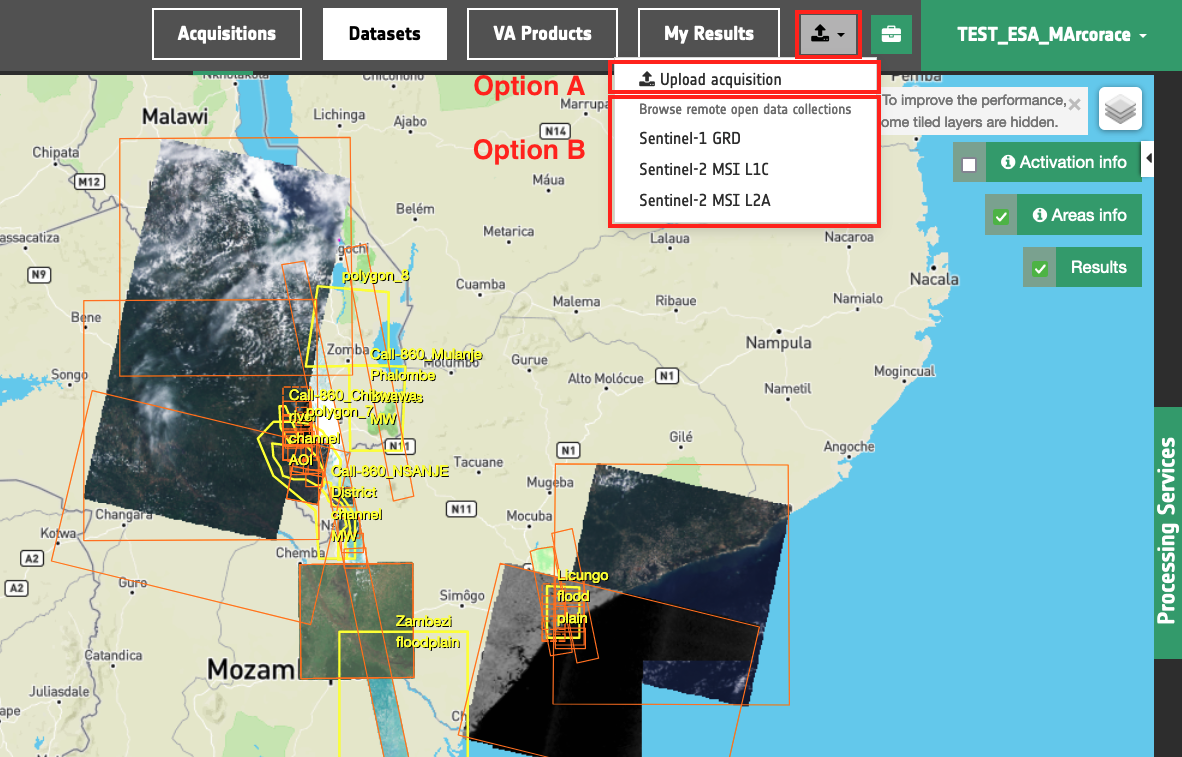
Once clicked on the Upload button, a dropdown menu will appear and two types of options are offered to the user for importing external EO data:
-
Option A: manual upload of a raster geospatial product
-
Option B: manual upload of a single acquisition
-
Option C: browse multiple free EO data collections and choose the acquisition/s to import
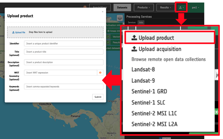
Option A: Manual upload of a raster geospatial product
The first uploading option allows the user to upload a raster geospatial product generated outside the Charter Mapper. After the upload the resulting single or multi band asset can be used for visualisation with the assets selection and layer styling functions and for processing using the services available on the platform. For more information refer to this section of the user manual.
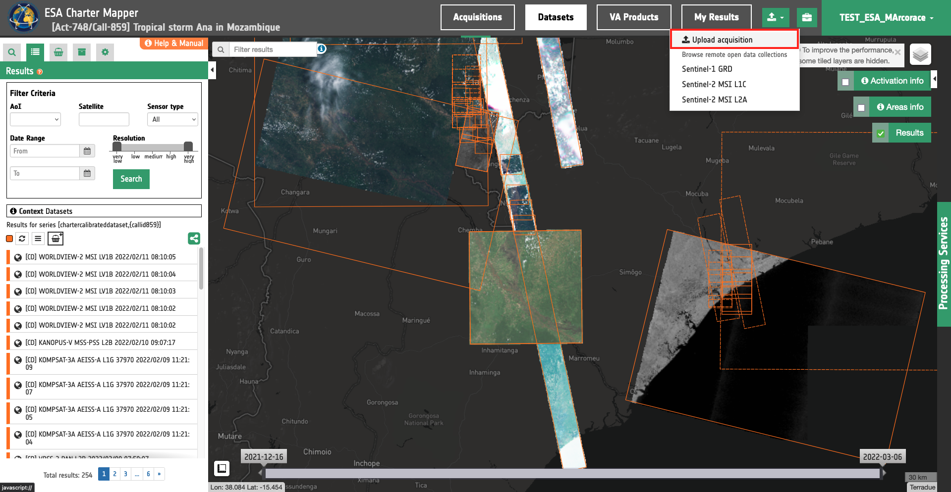
Option B: Manual upload of a single acquisition
This second uploading option allow PM/VA to manually upload a single external product into the workspace. To upload a product users must click on the relative button Upload acquisition, located on the top-right of the application:
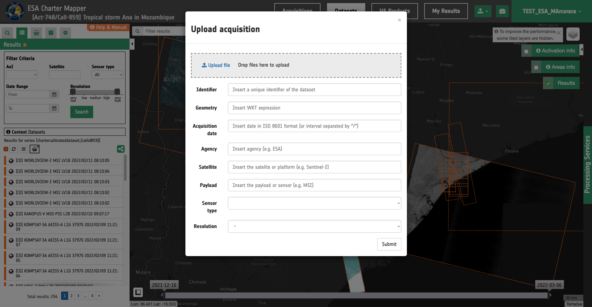
A modal dialog form is opened. Users can choose a file by clicking on the Upload file button or by directly dropping a file inside the drop area. After the specification of the file to be uploaded, users must fill the form to include product metadata information.
-
Identifier: a string representing the unique identifier of the dataset,
-
Geometry: a string for the image footprint polygon in WKT format 1,
Warning
The product footprint shall be a geometry in WKT format. The typical entry in WKT syntax assuming a polygon with 4 vertexes is the following:
POLYGON((lon1 lat1,lon2 lat2,lon3 lat3,lon4 lat4,lon1 lat1))
Longitude and Latitude coordinates of each vertex are separated by a space. Coordinates of each vertex are comma separated.
-
Acquisition date: a string representing the sensing date expressed in ISO 8601 format 2,
-
Agency: to insert the name of the agency,
-
Satellite: to insert the name of the satelite/platform,
-
Payload: to insert the name of the payload/sensor,
-
Sensor type: to choose among Optical or SAR,
-
Resolution: to specify the Product Resolution by choosing among the following options: Very High, High, Medium, Low and Very Low resolutions. Resolution classes 3 are defined in Table 1.
| Key | Resolution |
|---|---|
| Very Low | Very Low Resolution: GSD > 1000m |
| Low | Low Resolution: 300m < GSD <= 1000m |
| Medium | Medium Resolution: 30m < GSD <= 300m |
| High | High Resolution: 4m < GSD <= 30m |
| Very High | Very High Resolution: GSD <= 4m |
Table 1 - Definition of resolution classes for EO products.
An example of duly filled form is the one shown in Table 2.
| Field | Value |
|---|---|
| Identifier | TSX1_SAR__EEC_RE___SM_S_SRA_20210922T205440_20210922T205448 |
| Geometry | POLYGON((-39.261 -15.043,-39.368 -14.539,-39.071 -14.479,-38.968 -14.983,-39.261 -15.043)) |
| Acquisition Date | 2021-09-22T20:54:40Z |
| Agency | DLR |
| Satellite | TerraSAR-X |
| Payload | sar-x |
| Sensor type | SAR |
| Resolution | High |
Table 2 - Example of filled form for the manual import of a TerraSAR-X SM EEC product.
After submitting the form, the file is uploaded and the acquisition is created. Like for the import of external EO data, the ingestion and calibration process could take several minutes.
Warning
Before importing an EO data product, please consult the list of supported sensors available here.
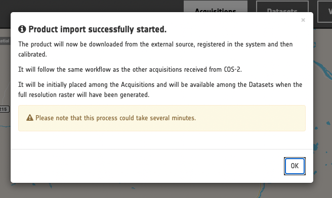
Note
The ingestion of an EO product is a process composed in steps: the product will be downloaded from the external source, registered in the system, ingested and calibrated, as the acquisitions workflow from COS-2. Therefore this process could take several minutes to produce a calibrated dataset, visible on the map with a full resolution overview inside the "Dataset" context menu.
Option C: Import of single or multiple acquistions from Free EO data collections
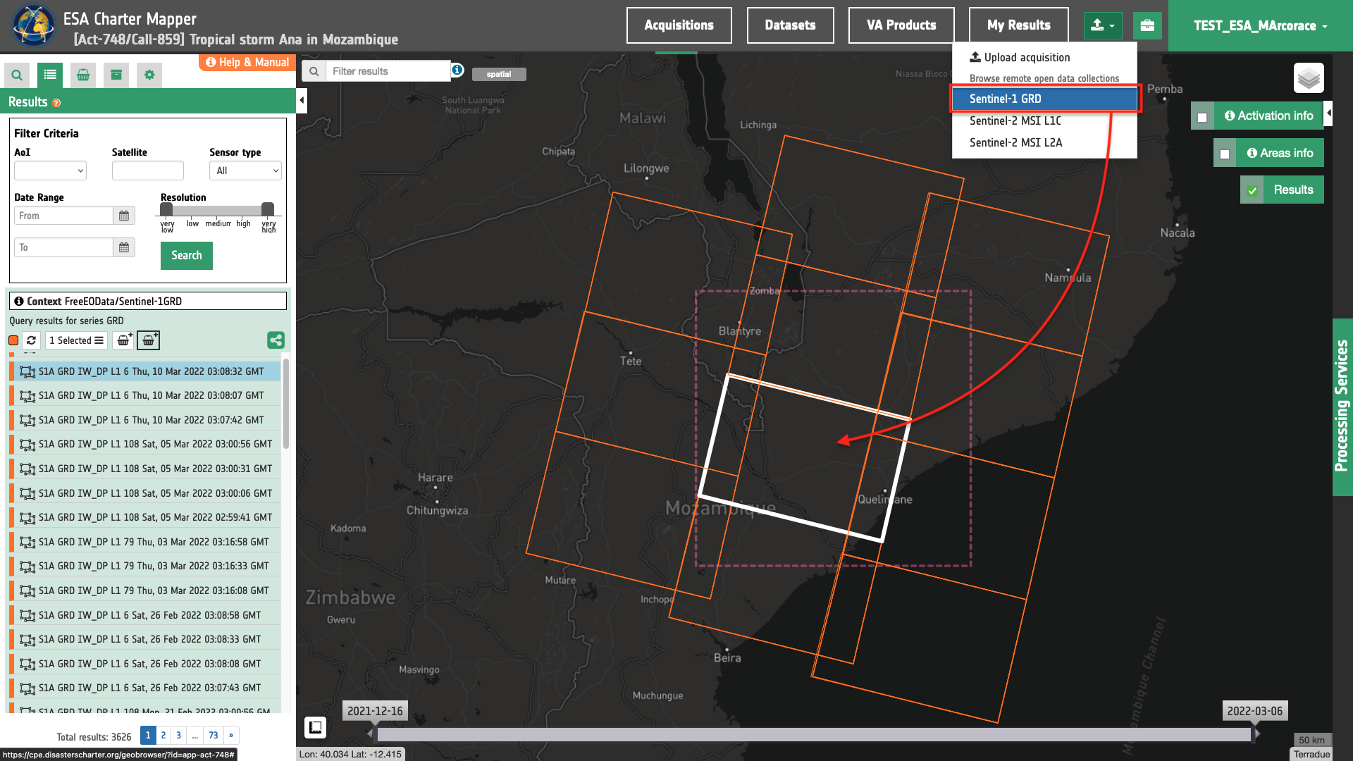
Users can also browse free EO data collections (e.g. Sentinel-1 GRD), select one or more EO products from the catalog and trigger the ingestion of them into the disaster workspace. To do this, from the Upload dropdown menu the user has to click on one EO data series from the list.
Note
Free EO data collections currently supported are the following: Landsat-8, Landsat-9, Sentinel-1 GRD, Sentinel-1 SLC, Sentinel-2 L1C, and Sentinel-2 L2A.
Once an EO data series is selected the current search will switch to the relative EO data catalaog and users can navigate, filter EO products, accesss product metadata and quicklook, and visualize image footprints on the map.
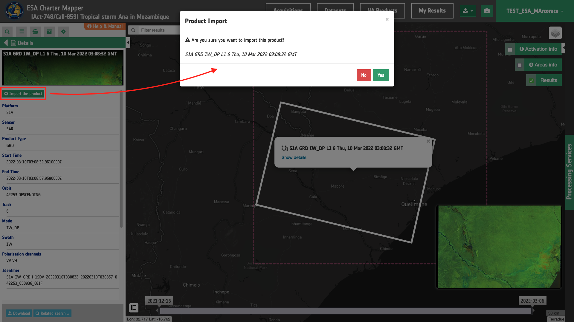
By opening a specific feature product, on the Details panel, a button "Import the product" is present on the top.
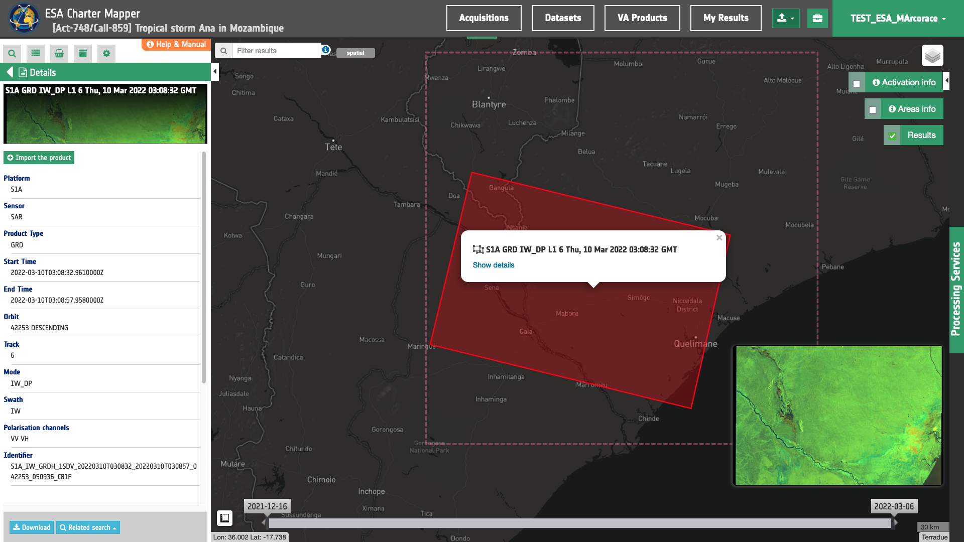
User can click here to import and ingest the selected EO product into the workspace as a new acquisition. After this interaction the new acquisition product is immediately added to the ESA Charter Mapper catalogue and the footprint visible on the map.
Note
The ingestion of an EO product is a process composed in steps: the product will be downloaded from the external source, registered in the system, ingested and calibrated, as the acquisitions workflow from COS-2. Therefore this process could take several minutes to produce a calibrated dataset, visible on the map with a full resolution overview inside the "Dataset" context menu.
Warning
Please note that Sentinel-2 L2A products are available online at the ESA data hubs and at the DIAS only for about last three months. Import of products with acquisition date older than three months could indeed fail.
Tip
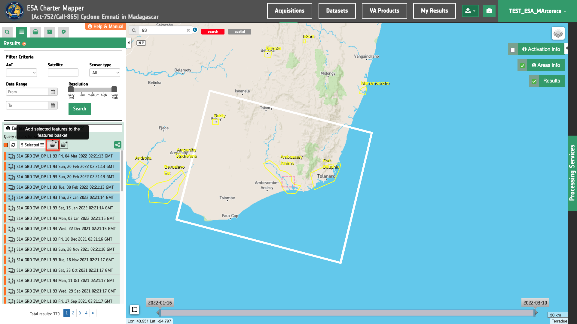
To faciliate the import of multiple acquistions from the EO data collection the user can also easily triggered the process via the Feature Basket. To do so the user can simply select the acquisitions of interest in the Results panel and click on Add selected features to the features basket.
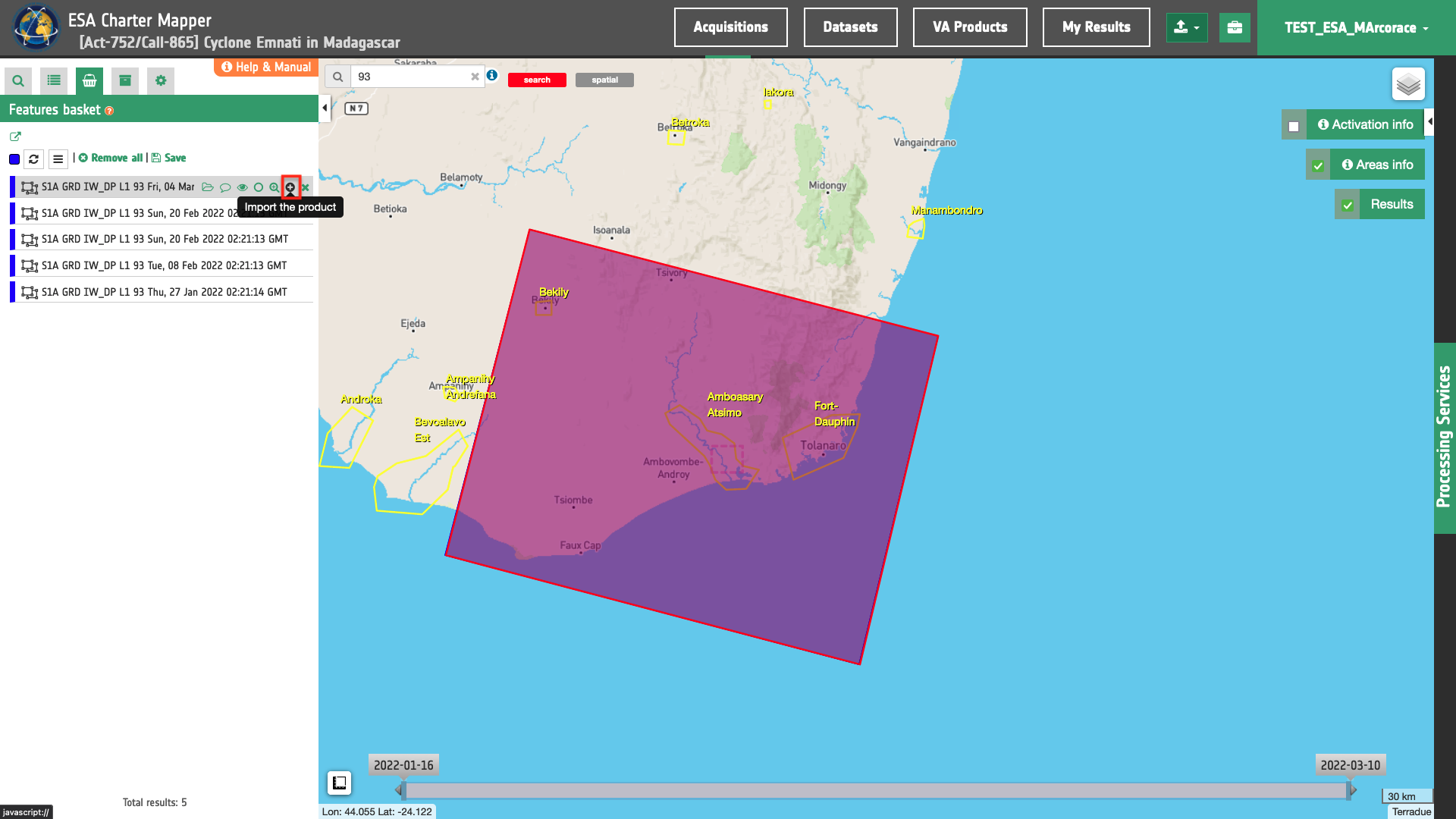
Once inside the Features Basket a list of the selected EO products will appear and the user can simply click on the Import the product button one by one for each feature.
-
Open Geospatial Consortium, Well-known text representation of coordinate reference systems, available at https://www.ogc.org. ↩
-
ISO, SO 8601 Date and time format, available at https://www.iso.org. ↩
-
Copernicus, Mission Groups and resolution classes, available at https://spacedata.copernicus.eu. ↩