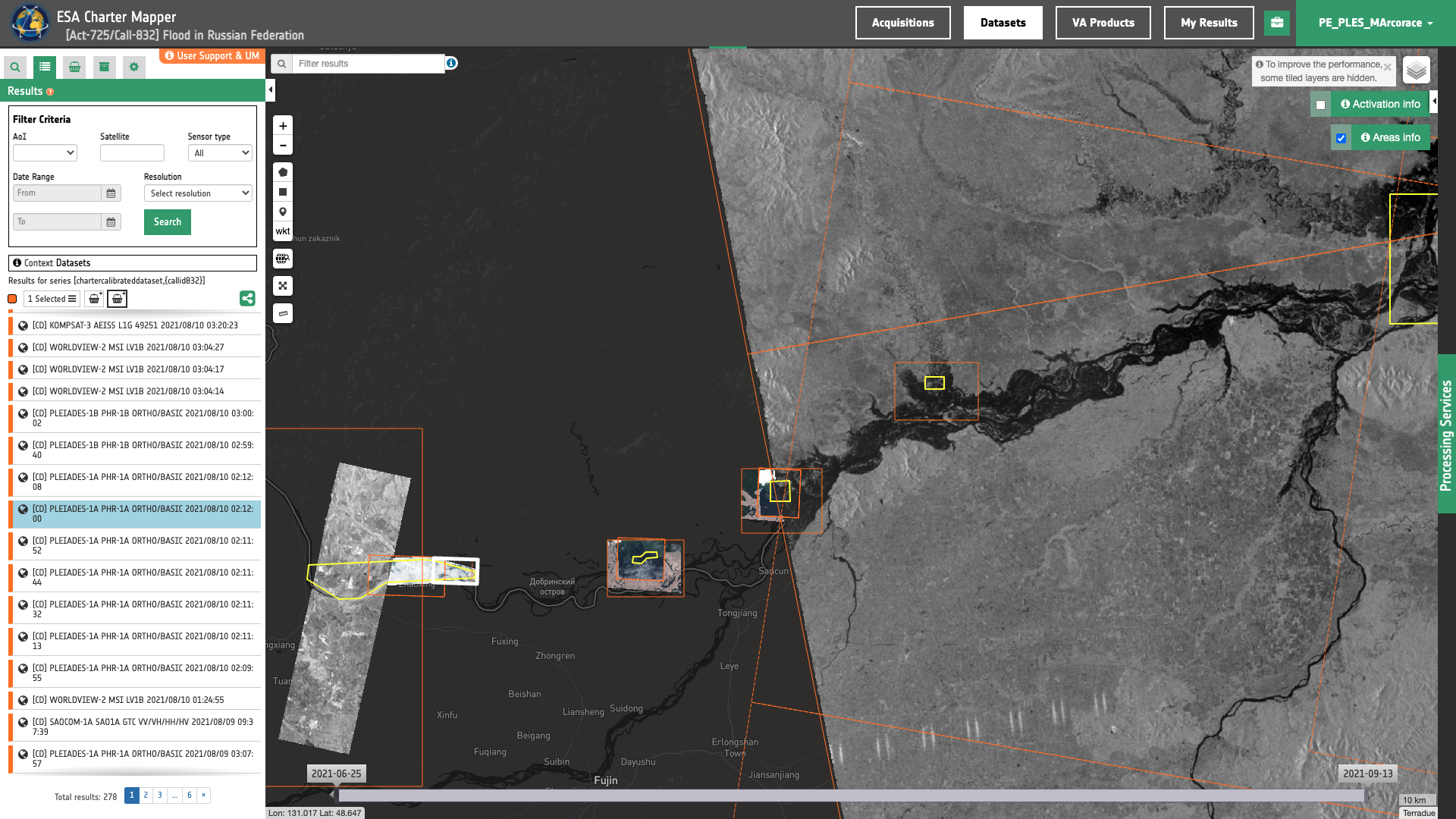
Geobrowser: introduction
The geobrowser is a map-based web application, allowing users to perform data exploration, data visualization, data analysis and data processing.

The geobrowser is based on a "current search" concept. The "current search" is an entity representing the data of the catalog we are currently navigating. It is defined on the couple {current opensearch description, current search parameters}:
- The opensearch description is a document (retrieved by an opensearch description url) describing the data we are exploring in a given moment including how we can search the data, what are the search parameters and how each parameter works. From the opensearch description the geobrowser creates a search engine and populates a dynamic search form.
- The current search parameters is a set of parameters values and filters, from which we can have a search result to show on the geobrowser.
On the geobrowser, users can change and manipulate the current search in 2 ways:
-
By changing the current opensearch description: a workspace offers a list of defined OpenSearch configurations in a tree menu called Contexts Menu. Morehover, you can also change the current search by showing a result of a processing job, or by switching on a correlated search.
-
By applying some filters changing parameters values: all parameters are included in the Search Panel form, but for some predefined parameters there is also a utility widget on the map, to make more intuitive the interaction to change the values. For example the search terms, the spatial query buttons and the date are represented as widgets inside the map.
A current search always involves a current search result, which is the search result on the catalog with a specific opensearch description and a specific parameters values set. That result is on OWS context standard, encoded in geoJSON format, and contains a list of results entries called Features. Each feature is shown on the Results Panel, and a details view for a selected feature is offered to show all the features info. Morehover, the features containing geographic information (like bounding box, map image, WMS service) are also visible and represented on the Map Services panel.
Each component of the geobrowser is described on the layout section.
Requirements
The Geobrowser is supported on several browsers, platforms and screen sizes, but to have the best experience and interactivity with the web application, there are some recommended requirements.
-
Supported browsers
- Chrome (v. ≥ 41)
- Firefox (v. ≥ 48)
- Safari (v. ≥ 11)
- Microsoft Edge (v. ≥ 44)
-
Screen size
- Minium: 1024x768
- Optimal: 1920x1080
Geobrowser and Workspaces
The Geobrowser application is completely configurable for any data analysis application. On the Charter Processing Platform the geobrowser is used to allow users to explore, analyse and processing disaster activation and acquisition information. On this context, a geobrowser configuration application represents the Workspace.