BKA
Mission description
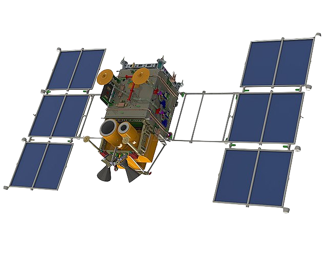
BKA (formerly known as BelKa 2) is a Belarusian remote sensing satellite developed by VNIIEM Corporation under an agreement between the National Academy of Sciences of Belarus (NAS) and the Federal Space Agency of the Russian Federation.
The BKA satellite is almost an exact copy of the Russian Kanopus-Vulkan N1 Environmental Satellite (Kanopus-V 1) and was launched on July 22, 2012 simultaneously with the Kanopus-V 1 satellite. These satellites are in the same orbit at opposite points and they carry similar sensors.
Table 1 provides a summary of the BKA mission.
| Parameter | Specifications |
|---|---|
| EO Mission | BKA |
| Mission Short name | BKA |
| Charter Owner Agency | NAS |
| Providing Agency | NAS |
| Date of launch | 22/07/2012 |
| Temporal coverage | 2012 - present |
| Mission status | onGoing |
| Mission duration | 8 years |
| Orbit Height | 510 km |
| Inclination | 97.4 deg |
Table 1 - BKA mission parameters.
Instrument
BKA is equipped with a 2.1m panchromatic imager and a 10.5m multispectral imager1. Table 2 describes the spectral combinations of the BKA products often received in the Charter.
| Acronym | Instrument | Spectral Mode | Spectral Combination |
|---|---|---|---|
| PSS | Panchromatic Imaging System | PAN | Panchromatic single band (PAN) |
| MSS | Multispectral Imaging System | MUL | Multispectral 4 bands (Blue, Green, Red and NIR) |
Table 2 - BKA instruments and spectral combinations.
Spectral modes and bands
PAN
Table 3 reports technical specifications for the BKA PSS instrument in PAN mode.
| Parameter | Specifications |
|---|---|
| Instrument | PSS |
| Imager Type | Panchromatic Imaging System |
| Spectral mode | PAN |
| Scanning technique | Pushbroom mode observation |
| Resolution | High Resolution - O-MR (1 - 4m) |
| GSD | 2.1 m (nadir) |
| Swath | 23 km |
| Dynamic range | 10 bits per pixel |
| Revisit | 5 days |
| Data type | L1A, L1B, or L1C |
Table 3 - BKA PSS instrument technical specifications.
Wavelength, Center wavelength, Bandwidth (or FWHM), and common band name (CBN) for each spectral band of the BKA PSS sensor in PAN mode are described in Table 4.
| Spectral Band (ID) | Spectral interval (nm) | Center Wavelength(µm) | Bandwidth or FWHM (µm) | CBN |
|---|---|---|---|---|
| BAND1 (PAN) | 520-860 | 0.660 | 0.208 | pan |
Table 4 - Spectral bands for a BKA PSS product.
MUL
Table 5 reports technical specifications for the BKA MSS instrument in PAN mode.
| Parameter | Specifications |
|---|---|
| Instrument | MSS |
| Imager Type | Multispectral Imaging System |
| Spectral mode | MUL |
| Scanning technique | Pushbroom mode observation |
| Resolution | Medium Resolution - 0-MR (4 - 25m) |
| GSD | 10.5 m (nadir) |
| Swath | 40 km |
| Dynamic range | 10 bits per pixel |
| Revisit | 5 days |
| Data type | L1A, L1B, or L1C |
Table 5 - BKA MSS instrument technical specifications.
Wavelength, Center wavelength, Bandwidth (or FWHM), and common band name (CBN) for each spectral band of the BKA MSS sensor in MUL mode are described in Table 6.
| Spectral Band (ID) | Spectral interval (nm) | Center Wavelength(µm) | Bandwidth or FWHM (µm) | CBN |
|---|---|---|---|---|
| MS3 (Blue) | 450-520 | 0.492 | 0.04 | blue |
| MS2 (Green) | 510-610 | 0.558 | 0.07 | green |
| MS1 (Red) | 640-700 | 0.675 | 0.09 | red |
| MS4 (NIR) | 730-860 | 0.782 | 0.1 | nir |
Table 6 - Spectral bands for a BKA MSS product.
Geometric and radiometric processing
Processing levels of BKA products are:
-
L1A bundle of photos with RPC,
-
L1B georeferenced,
-
L1C orthorectified.
BKA products contain: preview, vector footprint, and metadata files. For L1B and L1C products, the PAN data is given as a single band grayscale at 8 bits and the MUL data is given as a 4-band composite (RGBN) at 8 bits.
Imagery and metadata formats
BKA's imagery format is GeoTIFF. Annotation is delivered in XML format.
Ingested format
Information extracted from product annotation included in the STAC item of a BKA L1C MSS dataset are listed below.
Properties
STAC item content about properties for a BKA L1C MSS Dataset is the following:
  "properties": {
    "datetime": "2015-09-24T04:43:01Z",
    "created": "2023-11-08T15:20:38.8820805Z",
    "platform": "bka",
    "constellation": "bka/kanopus-v",
    "mission": "bka",
    "instruments": [
      "mss"
    ],
    "sensor_type": "optical",
    "spectral_mode": "MUL",
    "gsd": 10.52,
    "title": "BKA MSS L1C 2015-09-24 04:43:01",
    "providers": [
      {
        "name": "NAS",
        "description": "BKA (formerly known as BelKa 2) is a Belarusian remote sensing satellite developed under an agreement between the National Academy of Sciences of Belarus (NAS) and the Federal Space Agency of the Russian Federation. The BKA satellite is almost an exact copy of the Russian Kanopus-Vulkan N1 Environmental Satellite (Kanopus-V 1).",
        "roles": [
          "producer",
          "processor",
          "licensor"
        ],
        "url": "https://gis.by/en/tech/bka/"
      },
      {
        "name": "NAS",
        "roles": [
          "licensor"
        ]
      }
    ],
    "licence": "proprietary",
    "disaster:call_ids": [
      968
    ],
    "disaster:resolution_class": "MR",
    "cpe:cos2_id": "968-4077631-0220-MUL-C-1-1-1100761-150924T044238-ID",
  }
Satellite
STAC item content about Satellite for a BKA L1C MSS Dataset is the following:
  "properties": {
    "sat:platform_international_designator": "2012-039B"
}
Processing
STAC item content about Processing for a BKA L1C MSS Dataset is the following:
  "properties": {
    "processing:level": "L1C"
  }
Projection
STAC item content about Projection for a BKA L1C MSS Dataset is the following:
  "properties": {
    "proj:epsg": 32748,
    "proj:shape": [
      6791,
      3052
    ]
  }
View
STAC item content about View for a BKA L1C MSS Dataset is the following:
  "properties": {
    "view:azimuth": 84.08
  }
Geometry
STAC item content about Geometry for a BKA L1C MSS Dataset is the following:
  "geometry": {
    "type": "Polygon",
    "coordinates": [
      [
        [
          106.57943576,
          -6.53408095
        ],
        [
          106.75134549,
          -6.50028809
        ],
        [
          106.63111111,
          -5.88778429
        ],
        [
          106.459375,
          -5.92148926
        ],
        [
          106.57943576,
          -6.53408095
        ]
      ]
    ]
  },
  "bbox": [
    106.459375,
    -6.53408095,
    106.75134549,
    -5.88778429
  ]
Assets
STAC item content about assets (annotation, quicklooks and spectral bands files harvested from the source product) and EO bands for a BKA L1C MSS Dataset is the following:
  "assets": {
    "L1C_MUL": {
      "type": "image/tiff; application=geotiff",
      "roles": [
        "data",
        "dn"
      ],
      "title": "L1C MUL",
      "href": "https://.../4077631-0220-MUL-C-1-1-1100761-150924T044238-ID/L1C_MUL.tif",
      "filename": "4077631-0220-MUL-C-1-1-1100761-150924T044238-ID.tif",
      "file:size": 84189866,
      "eo:bands": [
        {
          "name": "MS3",
          "common_name": "blue",
          "center_wavelength": 0.492,
          "full_width_half_max": 0.04
        },
        {
          "name": "MS2",
          "common_name": "green",
          "center_wavelength": 0.558,
          "full_width_half_max": 0.07
        },
        {
          "name": "MS1",
          "common_name": "red",
          "center_wavelength": 0.675,
          "full_width_half_max": 0.09
        },
        {
          "name": "MS4",
          "common_name": "nir",
          "center_wavelength": 0.782,
          "full_width_half_max": 0.1
        }
      ],
      "raster:bands": [
        {
          "data_type": "int8",
          "offset": 0
        },
        {
          "data_type": "int8",
          "offset": 0
        },
        {
          "data_type": "int8",
          "offset": 0
        },
        {
          "data_type": "int8",
          "offset": 0
        }
      ]
    },
    "metadata": {
      "type": "application/xml",
      "roles": [
        "metadata"
      ],
      "href": "https://.../4077631-0220-MUL-C-1-1-1100761-150924T044238-ID/metadata.xml",
      "filename": "4077631-0220-MUL-C-1-1-1100761-150924T044238-ID_pasp-en.xml",
      "file:size": 4652
    },
    "overview": {
      "type": "image/jpeg",
      "roles": [
        "overview"
      ],
      "href": "https://.../4077631-0220-MUL-C-1-1-1100761-150924T044238-ID/overview.jpg",
      "filename": "4077631-0220-MUL-C-1-1-1100761-150924T044238-ID_preview.jpg",
      "file:size": 138091
    }
  }
Product Calibration
For BKA products calibration refer to the Optical Products Calibration (OPT-Calib) service and the calibration sheet available here.
-
NAS, GIS, available at: https://gis.by. ↩