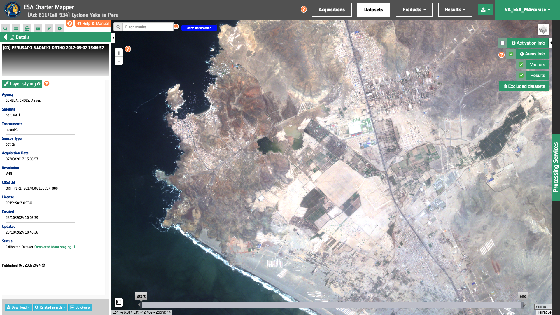
PerúSAT-1
PerúSAT-1 EO data products are calibrated using the Optical Products Calibration (OPT-Calib) service.

Input
The input is an ingested PerúSAT-1 dataset. Find details here.
DN to Radiance
The PerúSAT-1 product specifications 1, [^2] provides the formula below to convert the DN into radiance:
For the conversion from \(DN\) (for Digital Numbers) to spectral radiance (or ‘TOA radiance’) \(L \), the following formula is used :
As such, the calibration uses:
and
\(L \) in \(W/m^2/steradians/micrometers\) with \(b\) being a band ID.
Radiance to Reflectance
To convert TOA radiance to TOA reflectance, the following formula is used :
where :
-
\(L(b)\) is the spectral radiance for band b
-
\(pi\) is the famous mathematical constant
-
\(d\) is the earth-sun distance (in astronomical units) and depends on the acquisition’s day and month
-
\(ESUN(b)\) is the mean TOA solar irradiance (or solar illumination) in \(W/m^2/micrometers\)
-
\(θ\) is the solar zenith angle in degrees.
The values for the \(ESUN(b)\) are provided in acquisition metadata.
Output
The output is a STAC item GeoJSON[^6] including single band and overview assets in COG format. Below is given an example of assets included in the STAC item of a PerúSAT-1 ORT P MS panchromatic and multispectral calibrated dataset.
  "assets": {
    "pan": {
      "type": "image/tiff; application=geotiff; profile=cloud-optimized",
      "roles": [
        "data",
        "reflectance",
        "visual"
      ],
      "href": "https://.../ORT_PER1_20170307150657_000-calibrated/pan.tif",
      "eo:bands": [
        {
          "name": "pan",
          "description": "Raw radiometric counts (DN) to TOA Radiance (L). Formulae L=DN/GAIN+BIAS",
          "common_name": "pan",
          "center_wavelength": 0.6,
          "full_width_half_max": 0.15,
          "solar_illumination": 1706.514896
        }
      ],
      "raster:bands": [
        {
          "spatial_resolution": 0.7,
          "statistics": {
            "minimum": 0,
            "maximum": 8506,
            "mean": 1217.4952124835,
            "stddev": 853.89964070031,
            "valid_percent": 100
          },
      "file:size": 1803434460
    },
    "blue": {
      "type": "image/tiff; application=geotiff; profile=cloud-optimized",
      "roles": [
        "data",
        "reflectance",
        "visual"
      ],
      "href": "https://.../ORT_PER1_20170307150657_000-calibrated/blue.tif",
      "eo:bands": [
        {
          "name": "blue",
          "description": "Raw radiometric counts (DN) to TOA Radiance (L). Formulae L=DN/GAIN+BIAS",
          "common_name": "blue",
          "center_wavelength": 0.485,
          "full_width_half_max": 0.035,
          "solar_illumination": 1982.671954
        }
      ],
      "raster:bands": [
        {
          "spatial_resolution": 2.8,
          "statistics": {
            "minimum": 0,
            "maximum": 5587,
            "mean": 1419.8840835572,
            "stddev": 938.28194126355,
            "valid_percent": 100
          },
        "file:size": 98324886
    },
    "green": {
      "type": "image/tiff; application=geotiff; profile=cloud-optimized",
      "roles": [
        "data",
        "reflectance",
        "visual"
      ],
      "href": "https://supervisor.charter.uat.esaportal.eu/assets/calls/1033/acquisitions/calibratedDatasets/ORT_PER1_20170307150657_000-calibrated/green.tif",
      "eo:bands": [
        {
          "name": "green",
          "description": "Raw radiometric counts (DN) to TOA Radiance (L). Formulae L=DN/GAIN+BIAS",
          "common_name": "green",
          "center_wavelength": 0.56,
          "full_width_half_max": 0.03,
          "solar_illumination": 1826.087443
        }
      ],
      "raster:bands": [
        {
          "spatial_resolution": 2.8,
          "statistics": {
            "minimum": 0,
            "maximum": 5271,
            "mean": 1285.4166144486,
            "stddev": 885.15412538433,
            "valid_percent": 100
          },
      "file:size": 99829615
    },
    "red": {
      "type": "image/tiff; application=geotiff; profile=cloud-optimized",
      "roles": [
        "data",
        "reflectance",
        "visual"
      ],
      "href": "https://.../ORT_PER1_20170307150657_000-calibrated/red.tif",
      "eo:bands": [
        {
          "name": "red",
          "description": "Raw radiometric counts (DN) to TOA Radiance (L). Formulae L=DN/GAIN+BIAS",
          "common_name": "red",
          "center_wavelength": 0.665,
          "full_width_half_max": 0.035,
          "solar_illumination": 1540.494123
        }
      ],
      "raster:bands": [
        {
          "spatial_resolution": 2.8,
          "statistics": {
            "minimum": 0,
            "maximum": 6433,
            "mean": 1156.8321165976,
            "stddev": 862.1813449316,
            "valid_percent": 100
          },
        "file:size": 103915712
    },
    "nir": {
      "type": "image/tiff; application=geotiff; profile=cloud-optimized",
      "roles": [
        "data",
        "reflectance",
        "visual"
      ],
      "href": "https://.../ORT_PER1_20170307150657_000-calibrated/nir.tif",
      "eo:bands": [
        {
          "name": "nir",
          "description": "Raw radiometric counts (DN) to TOA Radiance (L). Formulae L=DN/GAIN+BIAS",
          "common_name": "nir",
          "center_wavelength": 0.8185,
          "full_width_half_max": 0.066,
          "solar_illumination": 1094.747446
        }
      ],
      "raster:bands": [
        {
          "spatial_resolution": 2.8,
          "statistics": {
            "minimum": 0,
            "maximum": 6947,
            "mean": 1135.2911862802,
            "stddev": 929.10154192129,
            "valid_percent": 100
          },
      "file:size": 106264305
    },
    "ndvi": {
      "type": "image/tiff; application=geotiff; profile=cloud-optimized",
      "roles": [
        "data",
        "visual"
      ],
      "href": "https://.../ORT_PER1_20170307150657_000-calibrated/ndvi.tif",
      "file:size": 273390839
    },
    "ndwi": {
      "type": "image/tiff; application=geotiff; profile=cloud-optimized",
      "roles": [
        "data",
        "visual"
      ],
      "href": "https://.../ORT_PER1_20170307150657_000-calibrated/ndwi.tif",
      "file:size": 271562553
    },
   "overview-trc": {
      "type": "image/tiff; application=geotiff; profile=cloud-optimized",
      "roles": [
        "composite",
        "visual"
      ],
      "href": "https://.../ORT_PER1_20170307150657_000-calibrated/overview-trc.tif",
      "file:size": 150043022
    },
    "overview-civ": {
      "type": "image/tiff; application=geotiff; profile=cloud-optimized",
      "roles": [
        "composite",
        "reflectance",
        "visual"
      ],
      "href": "https://.../ORT_PER1_20170307150657_000-calibrated/overview-civ.tif",
      "file:size": 150043022
    },
    "overview-trc-low-res": {
      "type": "image/tiff; application=geotiff; profile=cloud-optimized",
      "roles": [
        "composite",
        "overview",
        "reflectance"
      ],
      "href": "https://.../ORT_PER1_20170307150657_000-calibrated/overview-trc-low-res.tif",
      "file:size": 2181189
    }
  }
[2]: CARACTERISTICAS DEL SATÉLITE PERUANO PERUSAT-1. CONIDA Agencia Espacial del Peru V1.0, 1 page.
[3]: EO Portal, PeruSat-1 Earth Observation Minisatellite, available at: www.eoportal.org
-
Airbus Defence and Space, PerúSAT mission, available at: www.airbus.com ↩